Daily Briefing
Sunday
November 16, 2025

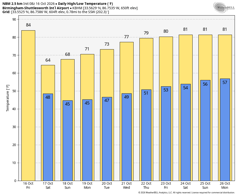
A cold front will bring a brief pullback on temperatures for the northern half of the state through Monday, with lows tonight across the Tennessee Valley reaching the 30s in a few spots, 40s across the rest of the northern half of the state.
ALABAMA YESTERDAY
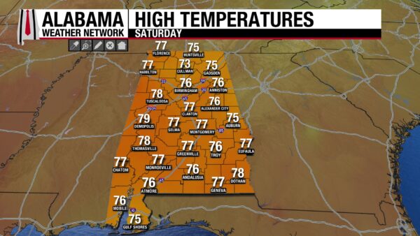
Saturday delivered another warm, dry November day across Alabama ahead of a weak front approaching from the northwest. Highs ranged from 73F at Cullman to 79F at Demopolis, with everyone else in the middle and upper 70s.
ALABAMA THIS MORNING
A weak front is sliding through Alabama early this Sunday morning. much of the state is waking up to more cloudiness than the past few days with temperatures in the 50s. There could be a sprinkle over Northeast Alabama this morning, but the chance your windshield will catch a drop is low.
ALABAMA 7 DAY FORECAST
Today’s front brings a subtle step down in temperatures and a brief uptick in clouds, but it’s not rain-maker. Cooler, drier air settles in tonight, then a warming trend resumes early in the workweek. As a stronger western U.S. storm system develops midweek, Alabama will move back into a warm, moist air mass with increasing chances for showers and a few thunderstorms, especially across the northern half of the state.
MONDAY: COOL START, WARM AFTERNOON
Monday looks like a classic late-fall rebound day. After a cool, clear morning, sunshine and light southerly breezes will send highs back into the low 70s north and mid to upper 70s central and south. Clouds will gradually increase Monday night, especially over north Alabama, as a warm front lifts northward and moisture begins to deepen. Overnight lows Monday night will hold in the upper 40s north and low to mid 50s central and south. A few showers could brush far north Alabama late Monday night, but most areas stay dry.
TUESDAY: WARM SECTOR RETURNS WITH SCATTERED SHOWERS NORTH
On Tuesday, our region becomes more firmly entrenched in a warm, moist air mass as low pressure organizes over the central U.S. and a warm front lifts north. Expect partly to mostly cloudy skies with highs in the upper 60s to low 70s north and mid to upper 70s elsewhere.
MIDWEEK: INCREASING RAIN AND STORM CHANCES
By Wednesday and Thursday, an amplified upper trough over the Desert Southwest and southern Plains will help draw deeper Gulf moisture northward. The details still depend on how quickly the western system ejects and how far south the strongest energy tracks, but the broad idea remains that the subtropical ridge across the Gulf protects us from rain, with showers remaining just to our north and west. Highs will be in the 70s, with a few readings near 80F over the South. Lows will warm back toward the 50s statewide.
LATE WEEK: UNSETTLED, THEN TRENDING COOLER
By Friday, the western system and its attendant cold front should be advancing farther east across the Mississippi Valley. For Alabama, that likely means a day with clouds, scattered showers, and perhaps a few thunderstorms, especially across the northern half of the state. Highs Friday will range from the upper 60s north to the low and mid 70s south, with lows generally in the 50s. Depending on how quickly the front clears, next weekend may trend cooler and drier behind the system.
NATIONAL HIGHLIGHTS
SOUTHERN CALIFORNIA STORM WINDING DOWN
The heavy rain event that pounded Southern California Friday and Saturday is gradually winding down today as the upper low and its moisture plume lift inland and weaken. Showers will linger this morning from the L.A. Basin into the Transverse Ranges and southern Sierra Nevada, but rainfall rates will steadily diminish through the day. Even as the rain tapers off, streams and rivers will remain elevated, and saturated slopes will stay vulnerable to additional minor slides and debris flows. Travel across mountain passes and canyon roads may still be impacted by leftover mud, rocks, and standing water.
NEXT PACIFIC SYSTEM TARGETS CENTRAL AND NORTHERN CALIFORNIA
The atmosphere stays active along the West Coast. A second upper low dropping south from the Pacific Northwest toward northern California will drive a cold front ashore later today and tonight. This will spread a new round of rain into central and northern California and southwest Oregon. Rainfall amounts with this system are expected to be lighter and more progressive than the Southern California storm, but recent wet ground and terrain-focused bands of heavier showers will support localized flooding issues, especially in central and northern California coastal hills and interior valleys.
RECORD WARMTH CONTINUES ACROSS TEXAS AND THE SOUTHERN PLAINS
The core of the warm ridge shifts a bit farther south today, but the story remains the same: it feels more like late September than mid-November from Texas into parts of the lower Mississippi Valley. Many locations will be within a degree or two of record highs again this afternoon, including:
…Austin, San Antonio, and Houston, Texas, with highs in the mid to upper 80s
…Abilene, Midland, and San Angelo back into the mid 80s
…Portions of deep South Texas pushing around 90 degrees
Humidity levels will be higher than in the central Plains, but the warmth is impressive for November and keeps cooling bills low and early winter energy demand in check across much of the South.
QUIETER BUT COOLER ACROSS THE NORTH
Behind the weekend front, the Northern Plains, Upper Midwest, and interior Northeast settle into a cooler, more seasonable pattern. Highs will generally be in the 40s and 50s, with a few 30s in parts of the Upper Midwest and northern New England.
Light rain and snow showers may linger today downwind of the Great Lakes and in higher terrain, but no major winter storms are on the immediate horizon for the northern tier.
SEVERE WEATHER OUTLOOK
No organized severe weather is expected across the country today. A few ordinary thunderstorms may bubble up across parts of the Southwest and Great Basin ahead of the next western trough, but instability will be weak and storms should remain below severe limits. Late tonight, a few elevated thunderstorm clusters may begin to develop from the southern Plains into the mid-Mississippi Valley as low-level moisture increases, but any strong storms should remain isolated and primarily a lightning and brief downpour threat.
TROPICS REMAIN IN SLEEP MODE
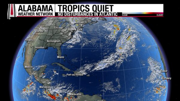
The Atlantic Basin continues to show no signs of tropical mischief. The National Hurricane Center does not anticipate any tropical cyclone development over the next seven days across the Atlantic, Caribbean, or Gulf of Mexico. As we move deeper into November, climatology and current patterns both favor a quiet endgame to the season.
SUNNY AND MILD ALONG THE ALABAMA AND NORTHWEST FLORIDA COAST
It’s another great beach day from Gulf Shores to Panama City Beach. Expect:
…Partly to mostly sunny skies
…Highs in the mid 70s near the beaches, upper 70s just inland
…Light north to northeast winds this morning turning more easterly this afternoon
…Surf around 1 foot with water temperatures in the mid 60s
The rip current risk remains LOW, though as always, localized dangerous currents can form near piers, jetties, and sandbars. Conditions remain favorable for beach plans through much of the upcoming week, with only modest changes in temperatures and winds.
TODAY IN WEATHER HISTORY
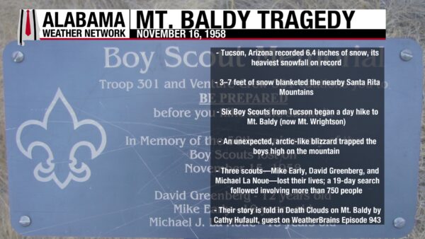
On November 16, 1958, Tucson, Arizona recorded 6.4 inches of snow, the city’s heaviest snowfall on record. The same storm buried the nearby Santa Rita Mountains under three to seven feet of snow, turning a mild autumn day into a deadly winter ordeal. Six Boy Scouts from Tucson set out for a day hike to Mt. Baldy, now known as Mt. Wrightson, unaware that an arctic-like blizzard was rapidly developing. Three turned back safely, but Mike Early, David Greenberg, and Michael La Noue continued toward the summit and were overtaken by the storm. The tragedy prompted a massive 19-day search, the largest in Arizona’s history, involving more than 750 rescuers. Their story is chronicled in Death Clouds on Mt. Baldy by Cathy Hufault, who appeared on WeatherBrains Episode 943 to share the lessons from that tragic day.

IMAGE OF THE DAY
Skywatcher Daniel Harbin sent this beautiful image of a buttermilk sky from the Paint Rock Valley on Saturday!