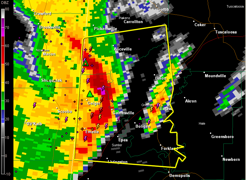
An intense line of storms with high potential for damaging winds is moving east through West Central Alabama at this hour.
The most intense winds will reach areas from Aliceville south to Gainesville then on to Epes shortly.
It will reach Union, Eutaw and Boligee by 10:20.
Winds may reach 70 mph or higher.
Large hail is also indicated between Geiger and Gainesville.
Severe thunderstorm warning continues for Pickens, Sumter and Greene Counties.
Look for a severe thunderstorm warning soon for southern Tuscaloosa, Hale and possibly Bibb and Perry Counties.
I think the damaging wind threat will stay south of the City of Tuscaloosa, down toward Moundville.