


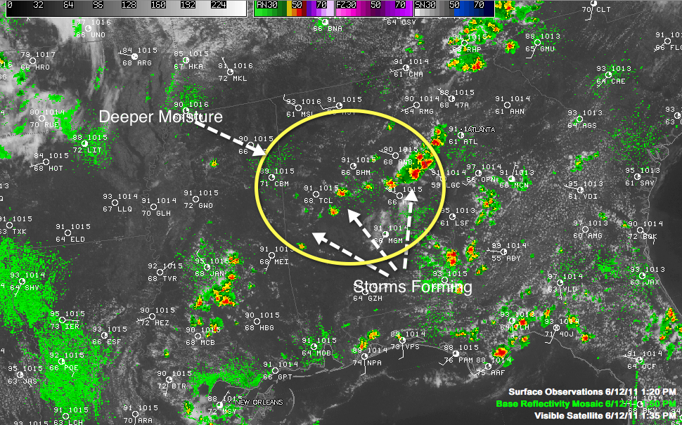
A nice field of cumulus clouds is now showing up across North Central Alabama, showing the area where storms are most likely to form.
It is roughly bounded by US-278 to the north and US-80 to the south.
The strongest storms right now are in southern Randolph County, approaching Wadley and Roanoke.
Next down the line is a strong storm near Goodwater that will be entering Tallapossa County…and traveling down 280 toward Alex City.
They are scattered back across Central Alabama to Bibb, Marion and Hale Counties. Another decent storm was near West Blocton.
The stronger storms will feature brief heavy rain, possibly as much as two inches in a short time, strong gusty winds, deadly lightning and even some hail.
A few of the storms may become severe, with hail to the size of quarters and some isolated damaging winds of 60 mph or greater.



