


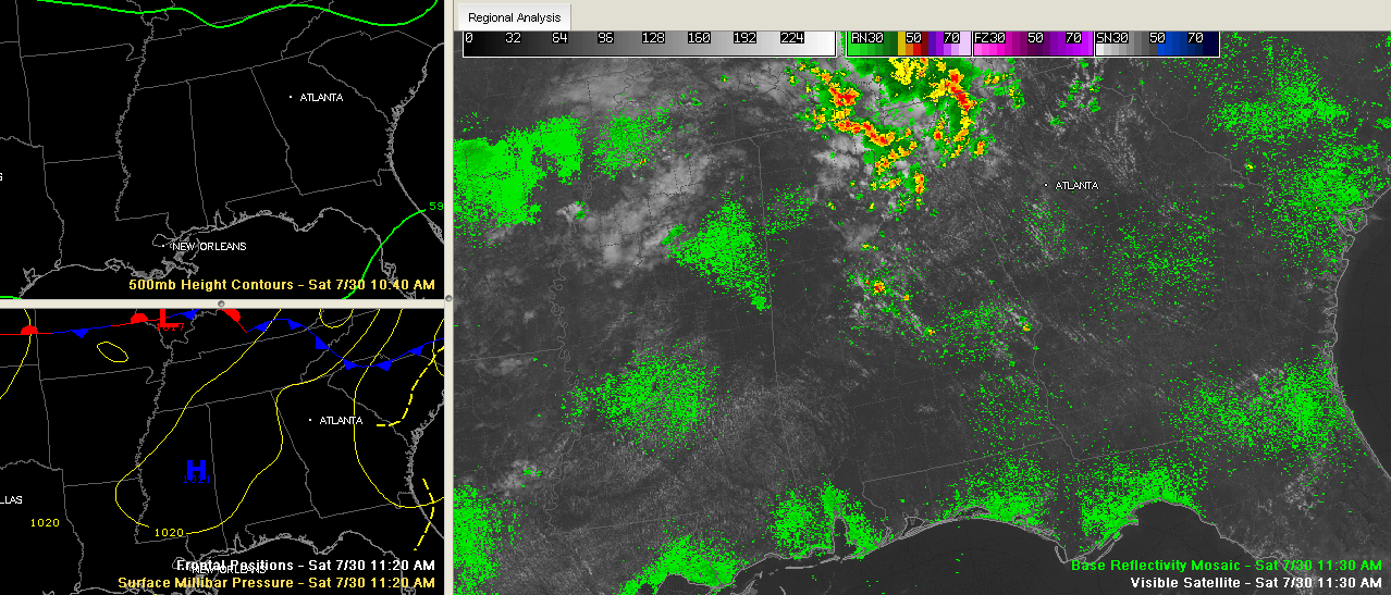
A subtle upper level disturbance pushing southeastward through Tennessee is rounding the northeastern edge of the subtropical ridge late this morning.
You could see some signs of this in the sky this morning, as patches of altocumulus clouds appeared. They indicate some mid-level instability. You didn’t need a model or a satellite picture to show you that!
It is triggering showers and storms over the northeastern quarter of Alabama. Some of them were producing heavy rain. A flash flood warning is in effect in Madison County, where nearly two inches of rain fell in a short time between Huntsville and the Hampton Cove area.
Storms were in the Gadsden/Attalla area.
Further south, storms were getting their act together over extreme southern Shelby and northern Chilton Counties south of Montevallo.
Also, storms were beginning to form in the Birmingham Metro area.
Everything is pushing east southeast.



