


Daily Weather Briefing
Sunday, August 30, 2026
ALABAMA THIS MORNING
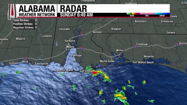
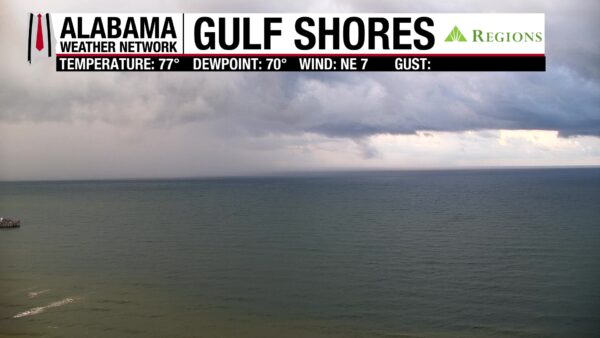
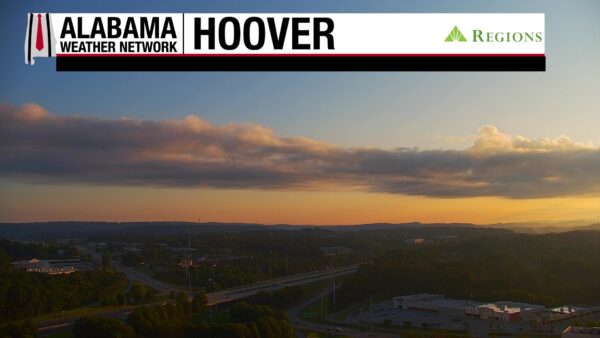
The low 70s and partly cloudy to mostly clear skies stretch across the state this morning. Alabama is dry except for a shower over Gulf Shores, which part of it can be seen on the Gulf Shores Regions Skycam. Our Regions Skycam on Hoover captures a beautiful yellow/orange sunrise as well.
ALABAMA 7 DAY FORECAST
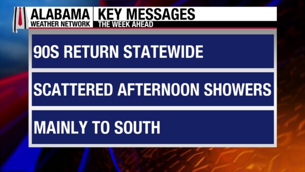
We continue to move into a hotter and drier pattern this week as an upper-level ridge to the west pushes its way into the Southeast. Most of the state’s rain chances will be low over the next seven days, but the southwest may see rainier days, especially today and tomorrow due to the weak low-pressure system moving west in the Gulf.
DRY NORTH, SCATTERED SHOWERS SOUTH TODAY – Aug 30
Today will be similar to the past few days: The northern half of Alabama will be dry or mostly dry throughout the day, while the southern half will see scattered afternoon showers and thunderstorms. Skies in the northern half of the state will be partly cloudy to sunny, and highs will reach the low to mid 90s, with the mid 90s favoring the western portion of the region. The southern half of the state, along with the scattered storms, will see highs in the low to mid 90s. The mid 90s are more likely in south-central Alabama, while the low 90s are expected in south Alabama. Storms in the southwest could be capable of producing flash flooding as well as being strong to severe at times.
TRENDING DRIER MONDAY – Aug 31
Tomorrow will be drier across the state as the southern half of the state will see rain chances drop to 20%. The entire state could still see an isolated afternoon or evening thunderstorm or two. Highs will be in the low to mid 90s statewide.
HOTTER AND DRIER FOR THE WEEK – Sept 1-4
Tuesday through Friday will see little change in the weather and will also not be so pleasant for those who are ready for fall. Rain chances will stay between 10-20% across Alabama, with some days seeing no rain chance at all. Highs will rise slowly each day. On Tuesday, they will reach the mid 90s over most of the state, but a few low 90s are still possible in the south. Wednesday’s highs will be in the mid 90s, with a few spots in west-central Alabama flirting with the upper 90s. By Thursday, the upper 90s will become a reality in west-central Alabama, while the rest of the state sits in the mid 90s. That temperature spread stays basically the same on Friday.
NO CHANGE HEADING INTO WEEKEND – Sept 5
Saturday will still be hot and mostly dry, with the mid to upper 90s stretching across the state.
RAINFALL OUTLOOK
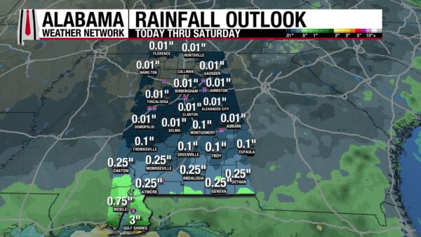
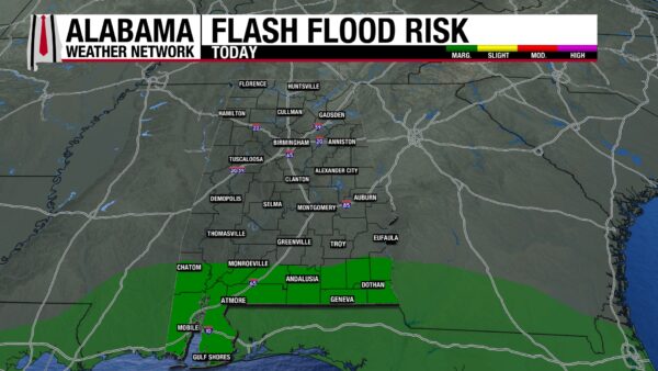
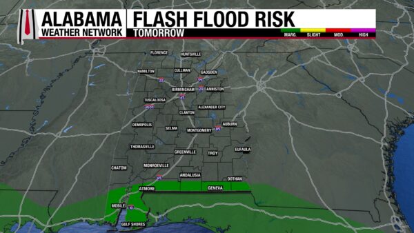
The northern two-thirds of Alabama will not receive more than an average of a tenth of an inch of rain this week. South Alabama will receive up to an average of a quarter of an inch. Coastal Alabama is the exception, as higher rain chances in the region due to the weak Gulf low will bring rainfall amount average to be between a third of an inch and maybe even 3 inches. 3 inches are expected toward the coast. Because of this Gulf low, a Marginal Risk (1/4) for Flash Flooding is in place across south Alabama today and tomorrow, as storms may produce heavy downpours that could cause flooding in low-lying and poorly drained areas.
THE ATLANTIC
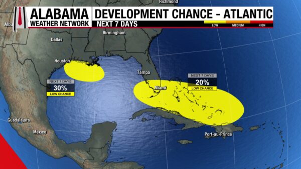
In the Atlantic, there are 2 disturbances that could develop into tropical systems over the next 7 days. AL97 sits in the Gulf 125 miles south of the coast of Louisiana and will move west this week. Interests in Louisiana and Texas should keep a careful eye on its forecast as it has a 30% chance of developing. The remnants of what was Tropical Storm Dolly are producing showers and thunderstorms over Puerto Rico and the eastern Virgin Islands. It has a 20% chance of development as it moves west-northwest toward the southeastern Gulf.
THE PACIFIC
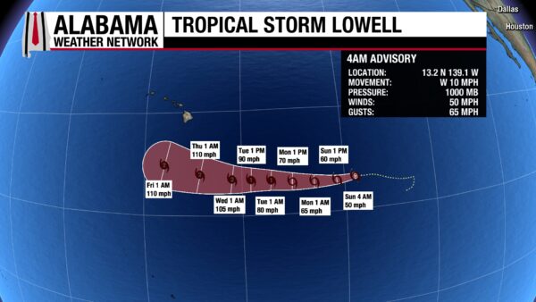
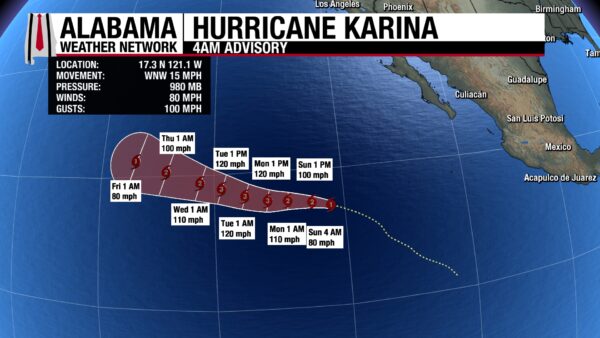
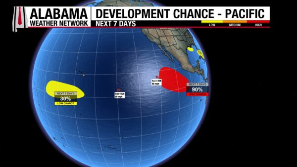
In the Pacific, Tropical Storm Lowell has sustained winds of 50 mph and a central pressure of 1000 mb. It will move west this week, strengthening to a Category 1 hurricane by Tuesday. Hurricane Karina is at Category 1 strength with sustained winds of 80 mph and a central pressure of 980 mb. It will move mostly west this week, strengthening to Category 3 status on Monday. Additionally, two disturbances could develop into tropical systems this week. One well southwest of Hawaii has a 30% chance over the next week, while one off the Pacific Coast of Mexico has a 90% chance.
RAINY DAYS AHEAD ON COAST
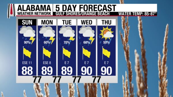
Today will be a rainy day on the coast thanks to the weak low-pressure system over the Gulf. With a 90% chance of showers and thunderstorms, skies will be mostly cloudy, winds will be from the east around 15 mph, and the high will be in the upper 80s. The rip current risk is Moderate today, and the surf height is around 2 to 3 feet. Rain chances drop some this week but still stay between 50 and 70%.
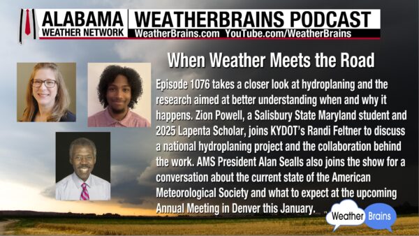
WEATHERBRAINS 1076
Tomorrow’s Weatherbrains episode will take a deep dive into hydroplaning, thanks to Zion Powell and Randi Feltner. President of the AMS, Alan Sealls, will also be joining the podcast to talk about the upcoming Annual Meeting in January. Listen to the episode wherever you get your podcasts or watch it here.
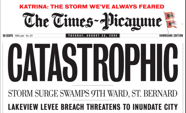
TODAY IN WEATHER HISTORY
August 30, 2005 – The City Underwater
By Tuesday morning, August 30, 2005, Hurricane Katrina was rapidly fading. At 4 a.m., the storm was over northeastern Mississippi with winds near 50 mph, and later that day it weakened to a tropical depression near Clarksville, Tennessee. But hundreds of miles behind Katrina’s center, the catastrophe in New Orleans was getting worse. Floodwaters were still spreading through neighborhoods, and the enormous scale of the disaster was only beginning to become clear.
Katrina’s storm surge had overwhelmed the system of levees and floodwalls surrounding greater New Orleans. In all, 53 breaches in the flood protection system were reported, including major failures along the 17th Street Canal, London Avenue Canal, and Industrial Canal. Because much of New Orleans sits below sea level, water entering through those openings could not simply drain away. By roughly 24 hours after landfall, about 80 percent of the city was underwater, with depths approaching 20 feet in some locations.
From the air on August 30, entire neighborhoods appeared transformed into lakes. Residents who had escaped rising water by climbing into attics eventually broke through roofs or moved onto rooftops, waving towels, sheets and anything else that might attract rescuers. Boats moved through streets that had become waterways while helicopters hovered above submerged homes. Thousands of people remained trapped in houses, buildings and on rooftops, beginning one of the largest urban rescue operations in American history.
The flooding also crippled the machinery designed to keep New Orleans dry. Pumping stations lost power, suffered damage or could not be operated, while the enormous volume of water pouring through levee breaches overwhelmed the system. 34 of the city’s 71 pumping stations were damaged. Before the city could be drained, engineers first had to close major breaches and restore enough pumping capacity to begin moving billions of gallons of water back toward Lake Pontchartrain.
The human consequences stretched far beyond the flooded neighborhoods. More than one million Gulf Coast residents were displaced from their homes, scattering families across Louisiana, Texas, and the rest of the country. The National Hurricane Center’s updated accounting attributes 1,392 deaths to Katrina, including 520 direct deaths, 565 indirect deaths, and another 307 for which the exact relationship to the storm could not be determined.
Getting the water out of New Orleans became a disaster response of its own. Crews worked to close levee breaches, repair pumps and gradually drain neighborhoods, only to have Hurricane Rita push water back into portions of the city weeks later. The U.S. Army Corps of Engineers finally completed the draining of New Orleans on October 11, 2005, 43 days after Katrina’s landfall.
August 30 demonstrated that a hurricane’s most dangerous chapter does not necessarily end when its winds weaken. Katrina was already racing away from the Gulf Coast, yet New Orleans remained trapped beneath floodwater, and a massive rescue effort was only beginning. The disaster exposed how vulnerable a city can become when extreme weather overwhelms the infrastructure built to protect it and showed that the greatest danger can sometimes emerge after the hurricane itself moves away.
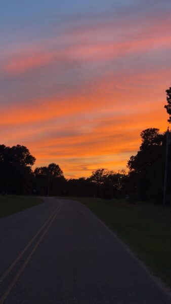
IMAGE OF THE DAY
Skywatcher Casey Waters captured the vibrant sunset in Ino last night!



