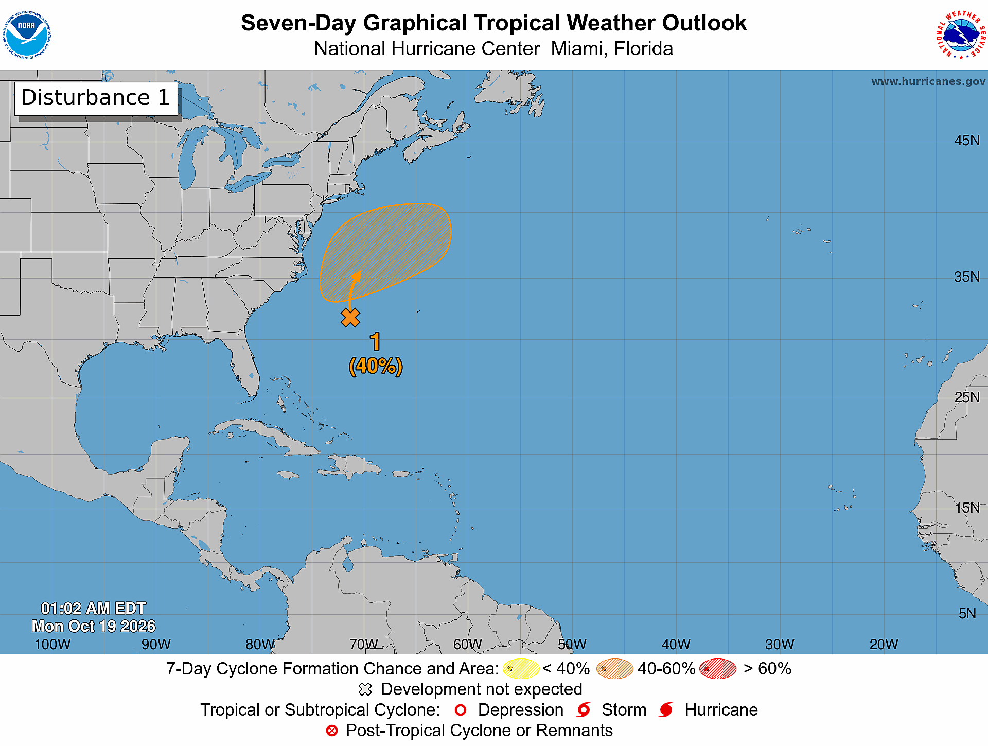
PLEASANT AFTERNOON: The sky is partly to mostly sunny across Alabama this afternoon with temperatures in the mid to upper 80s; humidity levels are still fairly low, and there is no rain on radar. Tonight will be mostly fair and pleasant…. most communities will see a low between 60 and 67, but again the cooler spots will visit the mid to upper 50s.
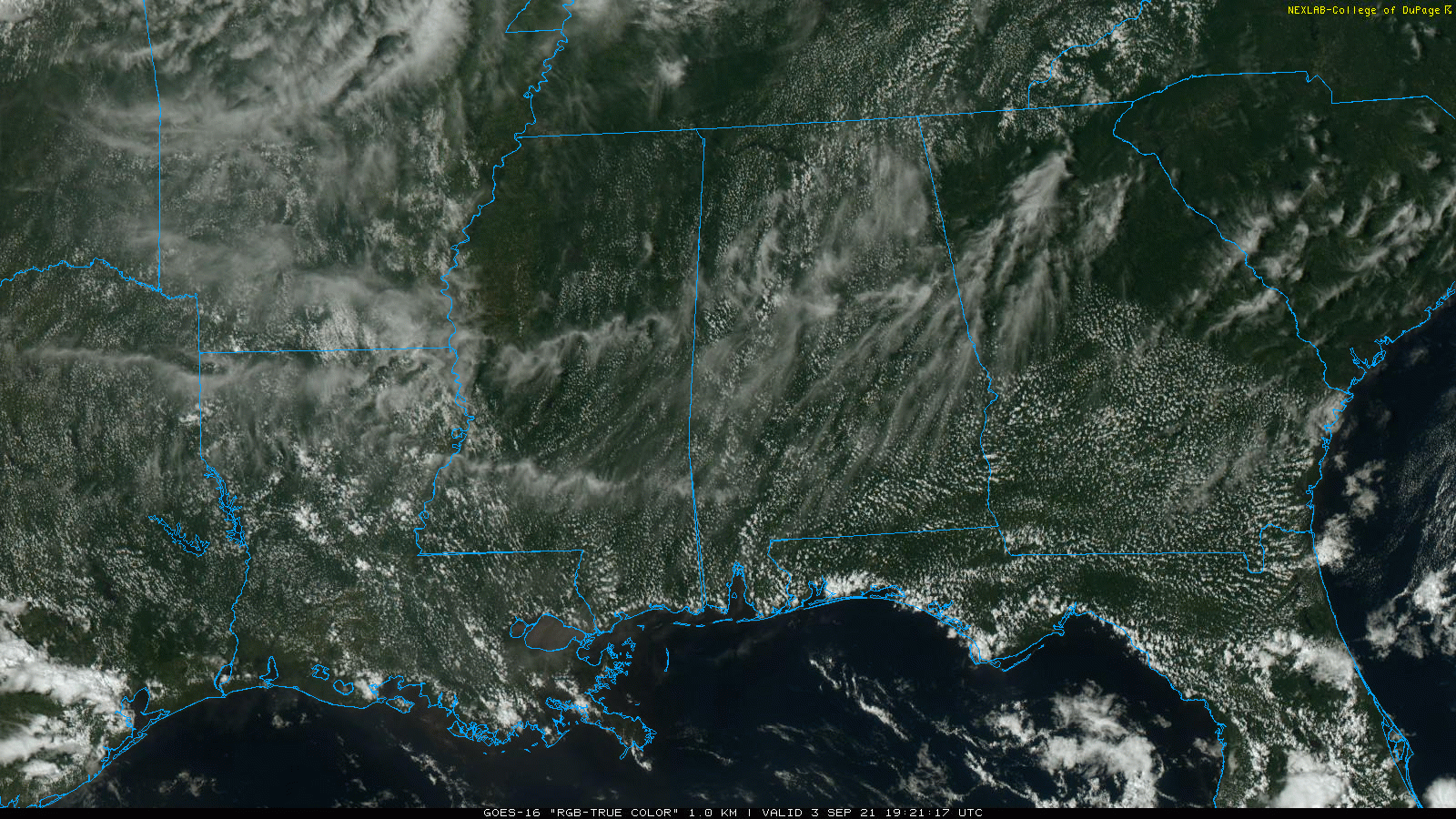
LABOR DAY WEEKEND: Mostly sunny weather continues tomorrow with a high in the upper 80s. The day Sunday will be generally dry with a partly sunny sky… the high will be in the 86-90 degree range. We will need to mention a chance of showers or thunderstorms over the northern third of the state late in the day and Sunday night as a disturbance drops southward from Tennessee.
On Labor Day look for a mix of sun and clouds, a few widely scattered showers or storms, and a high in the mid to upper 80s. Chance of any one spot getting wet Monday is only 15-20 percent.
REST OF NEXT WEEK: A few widely scattered showers and storms are possible Tuesday and Wednesday (highest coverage will likely be on Wednesday), followed by another surge of dry air Thursday and Friday. Highs will be in the 80s… See the Weather Xtreme video for maps, graphics, and more details.
FOOTBALL WEATHER: A great night for the high school football games tonight; the sky will be clear with temperatures falling from the low 80s at kickoff to the low 70s by the final whistle.
Alabama takes on Miami in Atlanta tomorrow (2:30p CT kickoff on ABC 33/40)… the game will be played at Mercedes Benz Stadium with the roof open; the weather will be great with a sunny sky along with temperatures in the 80s.
Auburn hosts Akron tomorrow night (6:00p CT kickoff at Jordan-Hare Stadium)… the sky will be clear with temperatures falling from 83 at kickoff into the mid 70s by the final whistle.
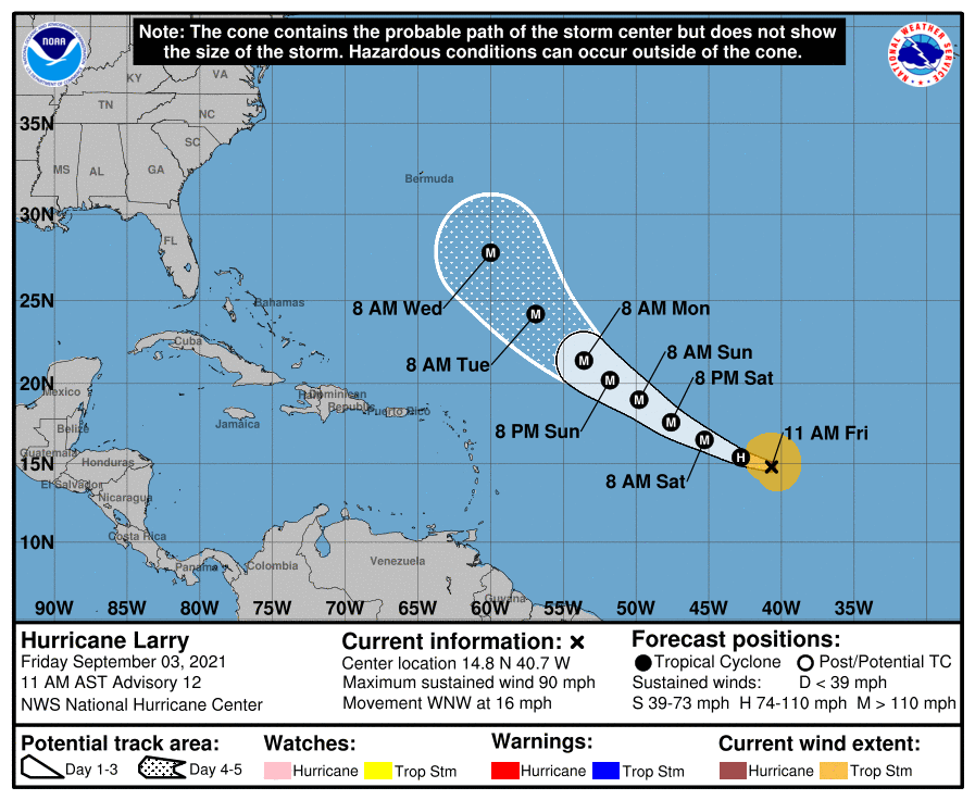
TROPICS: Hurricane Larry, with winds of 90 mph, is in the central Atlantic, and is expected to become a major hurricane tomorrow morning. It will recurve into the Atlantic well east of the U.S… but it will bring swells and rip currents to the Atlantic Coast of the U.S. early next week.
A surface trough over portions of Central America and the southern Yucatan Peninsula of Mexico is producing disorganized shower and thunderstorm activity. This system is expected to move west-northwestward during the next day or two, bringing locally heavy rains to these areas. The disturbance is expected to move over the southwestern Gulf of Mexico late this weekend, and then move northwestward to northward over the western Gulf of Mexico early next week. However, unfavorable upper-level winds could limit significant development during that time. NHC gives this system a 30 percent chance of development over the next five days.
ON THIS DATE IN 1970: During the early evening hours, amid a severe hailstorm at Coffeyville, Kansas, a stone 17.5 inches in circumference and nearly two pounds in weight was recovered. Average stone size from the storm was five inches in diameter, with another stone reportedly eight inches in diameter. This hailstone is currently the third-largest hailstone in the U.S.
ON THIS DATE IN 1979: Hurricane David made landfall in south Florida as a Category 2 storm. It caused 15 deaths in the US. Hurricane David was a Category 5 over the Dominican Republic were over 2,000 people died.
BEACH FORECAST: Click here to see the AlabamaWx Beach Forecast Center page.
WEATHER BRAINS: Don’t forget you can listen to our weekly 90 minute show anytime on your favorite podcast app. This is the show all about weather featuring many familiar voices, including our meteorologists here at ABC 33/40.
CONNECT: You can find me on all of the major social networks…
Look for my next Weather Xtreme video here by 6:00 a.m. Monday… enjoy the weekend!