


PLEASANT SPRING DAY: Temperatures are in the 70s across Alabama this afternoon with a good supply of sunshine through high, thin cirrus clouds. Tonight will be mostly fair with a low in the 50s for most places.
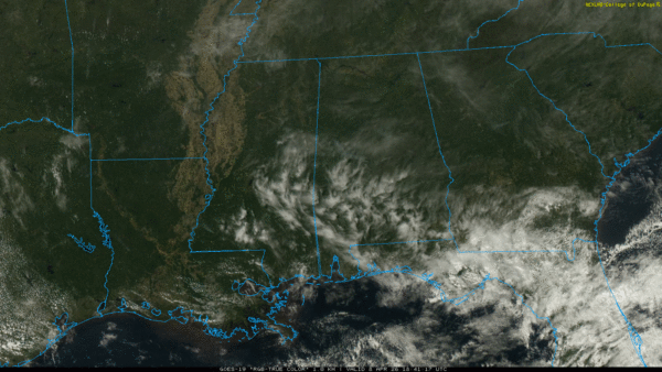
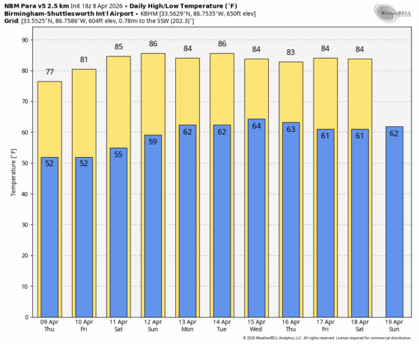
The calm weather pattern will persist across Alabama through the weekend with mostly sunny days and clear nights. Expect highs in the 73-80 degree range tomorrow, then rising into the 80s by Friday and the weekend.
NEXT WEEK: Not much change for the first half of the week; warm and dry with highs in the 80s. Active severe weather threats are expected well to the west of Alabama, but an upper ridge will keep us rain-free. The ridge will weaken late in the week which will open the door for at least some risk of showers by Thursday or Friday… See the video briefing for maps, graphics, and more details.
RAIN UPDATE: Here are rain totals for the year so far for major reporting stations across Alabama, and the departure from average. Deficiencies will continue to grow over the next 7-10 days.
Birmingham 15.09″ (-1.78″)
Anniston 13.91″ (-2.49″)
Huntsville 11.90″ (-4.73″)
Muscle Shoals 10.43″ (-5.38″)
Montgomery 9.53″ (-6.23″)
Dothan 8.69″ (-6.83″)
Mobile 7.68″ (-9.23″)
ON THIS DATE IN 1998: An violent F5 tornado cut a 31-mile long, 3/4-mile wide swath through nine Birmingham suburbs including Oak Grove, Sylvan Springs, Rock Creek, McDonald Chapel, Concord, Sylvan Springs, Pratt City, and Edgewater before lifting in the western limits of the City of Birmingham.
Thirty-two people were killed on that Wednesday night, many more were injured. The same parent storm would drop another tornado that killed two more people in St. Clair County near Wattsville.
Look for the next video briefing here by 6:00 a.m. tomorrow…



