


Daily Weather Briefing
Saturday, March 28, 2026
ALABAMA THIS MORNING
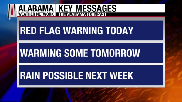
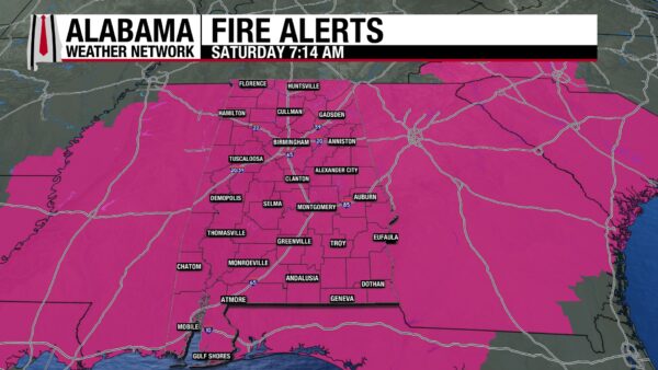
Some clouds are present over central Alabama this morning, while the north and south see clear skies. Winds are gusting anywhere from the upper teens to the lower 30s as the cooler, drier air from the cold front continues to push into the state. Temperatures sit in the low to mid 40s in north and north-central Alabama, the upper 40s and lower 50s in the south-central portion of the state, and the mid to upper 50s in the south. Wind chill temperatures are about 10 degrees lower than actual temperatures for the northern half of the state, while they are at or less than 5 degrees below the actual temperature in the southern half. A Red Flag Warning went into effect this morning at 7 a.m. CDT, indicating the elevated fire risk we see today. It expires tonight at 7 p.m.
ALABAMA 7 DAY FORECAST
After last night’s cold frontal passage, very dry air and windy conditions lead to an elevated fire risk across the state today. Cooler highs are also expected. Tomorrow will be warmer and will see the return of moisture. Monday sees the return of 80-degree weather, and Tuesday begins an afternoon showers trend that will last through Friday.
VERY DRY AND SOMEWHAT COOLER SATURDAY
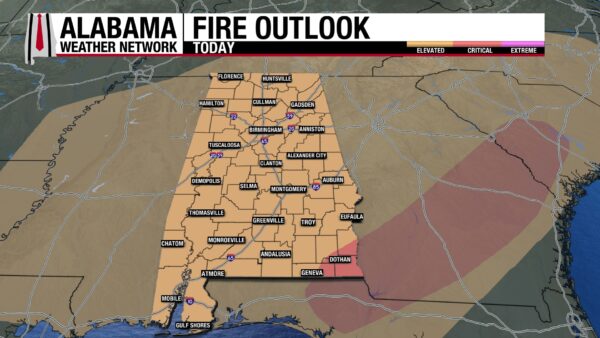
Very dry air is being advected into the state today by strong winds behind the cold front. Winds will gust in the 20s and upper 30s through noon today, then begin to taper off some into the mid-teens and 20s. Relative humidities across the state will stay at or below 25%, and these conditions combined have led to our Red Flag Warning mentioned above as well as an Elevated (1/3) Fire Risk issued by the Storm Prediction Center for the entire state. The very southeastern corner of Alabama is in a Critical (2/3) Risk. Fires have already burned in parts of the state this past week, so please do not burn or do activities with an open flame. Although highs will only reach the upper 60s north, mid to upper 60s in north-central Alabama, and the lower 70s in the southern half of the state, they will do little to mitigate the fire risk.
CHILLED NIGHT
Although it will not be as chilly tonight as it was last night, lows will still fall to the low to mid 40s north, mid to upper 40s centrally, and upper 40s to lower 50s south. Some patchy cloud cover keeps these temperatures from getting much lower, but strong wind gusts may keep temperatures feeling cooler.
CALMER SUNDAY
Sunday will be calmer than today, as southeasterly flow will bring moisture into the atmosphere throughout the day. Winds may still be gusty at times, but the fire concern will be much lower tomorrow. Highs will reach the upper 60s and lower 70s statewide.
WARMER MONDAY
Warmer temperatures are expected on Monday. Highs will climb to the upper 70s in the northeastern half of the state and the lower 80s in the southwestern half of the state (think about cutting the state in half diagonally). There is a low chance of light showers in the south as afternoon showers have the potential to develop.
INCREASING RAIN CHANCES START TUESDAY
As temperatures stay relatively similar throughout the week, rain chances will increase by about 10% each day as moisture advection, daytime heating, and a low-pressure system to the northwest make more moisture available.
On Tuesday, highs will reach the low 80s across Alabama, while the coast will hit the upper 70s. There is a 10% chance of showers throughout the state as well.
Wednesday brings a 20% chance of showers and thunderstorms to the state as well as highs in the upper 70s and lower 80s.
Shower and thunderstorm chances increase again on Thursday to 30% statewide. Highs will range from the upper 70s and lower 80s in the north to the mid to upper 80s in central and south Alabama.
There is a 40% chance of showers in the northern half of the state and a 30% chance in the southern half on Friday. Showers will keep highs in the northern half to the mid to upper 70s, and to the lower 80s in the southern half.
VERY FEW CHANGES, DROUGHT STILL BAD FOR MUCH OF STATE
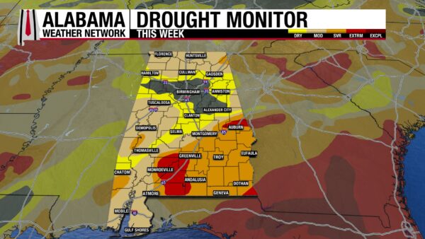
The good news is that the areas without drought have persisted into this week. The bad news is that some of the drought conditions have worsened (luckily not by much). North-central Alabama is still 11.49% drought-free. The Abnormally Dry category has decreased slightly because the Moderate Drought category has increased slightly from 39.92% to 40.65%. This means that a small number of the Abnormally Dry areas have worsened so much so that they now qualify for Moderate Drought conditions. A similar story has taken place for the Severe and Extreme Drought Categories. The Severe Drought category has decreased slightly, while the Extreme Drought category increased from 5.19% to 5.32%.
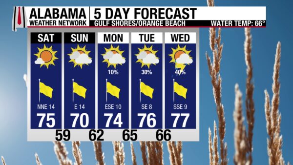
BREEZY BEACH
Winds will be breezy today, with sustained winds blowing at 15 to 20 mph. Gusts could reach 30 mph, especially before noon. This will be the only hindrance to a nice day on the shore. The high will be in the mid 70s, the UV Index is very high, and the skies are bright and sunny. Calm waters are expected again today as well, with a low rip current risk and a surf height of 2 to 3 feet.
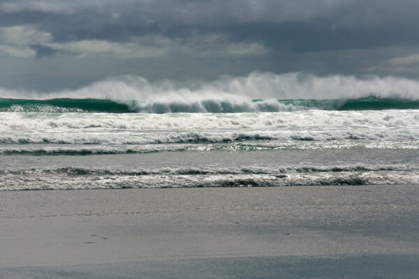
TODAY IN WEATHER HISTORY
March 28, 2014 – Florida Meteotsunami
On March 28, 2014, a rare meteotsunami struck portions of the Florida Panhandle as an intense squall line moved across the Gulf Coast. A meteotsunami is a rapid and often unexpected rise in water level caused by atmospheric disturbances such as squall lines, gravity waves, or other weather systems that transfer energy to the ocean surface. As the storms moved through, observers from Fort Walton Beach to Panama City Beach and Apalachicola reported a sudden surge of water rushing toward the shoreline, resembling a rogue wave. Tide gauges recorded a rise of about 2 to 2.5 feet in water levels, while some National Weather Service officials estimated localized rises of 4 to 5 feet. The surge pushed water over beaches and scattered items such as lounge chairs and kiosks, creating a chaotic scene along the coast. Fortunately, the event occurred while thunderstorms were already underway, keeping most people off the beaches, and no injuries were reported.
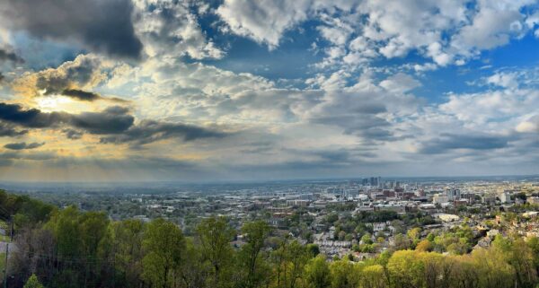
IMAGE OF THE DAY
Skywatcher Joey Amberson sent in this breathtaking photo of Birmingham from Vulcan yesterday!



