


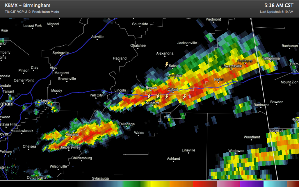
Storms that formed over Shelby County have gotten quite active this morning along I-20 from east of Lincoln through Anniston/Oxford to Heflin. Pea sized hail was reported a short time ago in Oxford.
The storms are not severe, and are not expected to become severe, but they will pack a punch with lightning, small hail, very heavy rain and potential winds to 40-50 mph. That can bring down tree limbs.
In Northwest Alabama, our line of storms extends now from northwest of Hamilton to Russellville to Harvest in Madison County. It is pushing southeast at 15-20 mph.
A single intense storm had developed north of Double Springs. It will pass north of Addison in Winston County.
A tornado watch remains in effect for most of North and central Alabama until noon.



