


Storms over East Central Alabama from Syalcauga/Gantts Quarry down to Goodwater and to north of Alex City have intensified rapidly in the past 30 minutes.
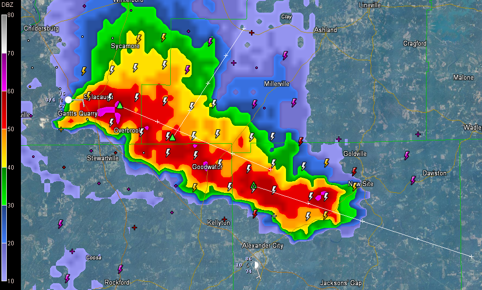
They’re not severe, but they are accompanied by tremendous lightning, torrential rains, strong gusty winds and maybe some small hail.
LATE REPORT: At 6:24, penny sied hail was reported in Sylacauga.
They are pushing southeast, so since they are oriented in a northwest to southeast direction, there may be some training of storm cells, resulting in pretty heavy rainfall amounts.
There are some strong storms south of Selma, but hey are pushing south.
Storms have pushed into Sumter and Pickens Counties in West Alabama, but they are weaker, as are most of the eastern Mississippi storms. Look for storms back to the west to work their way in here later today. The NWS Shreveport just issued a tornado warning for one of those cells in southern Arkansas.
Don’t expect tornadoes here overnight, but the storms could still produce damaging winds and hail late tonight in Alabama.



