


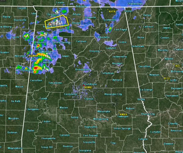
The second group of storms has now fully entered the west and northwestern parts of the area, stretching from Lexington southward through Hamilton and Fayette and coming to an end just south of Millport. All of this activity is pushing off to the east-northeast around 45 MPH.
We have just one Severe Thunderstorm Warning in effect for portions of Colbert, Franklin, and Lawrence counties until 7:30 pm for a cell that could produce damaging wind gusts up to 60 MPH and a brief tornado.
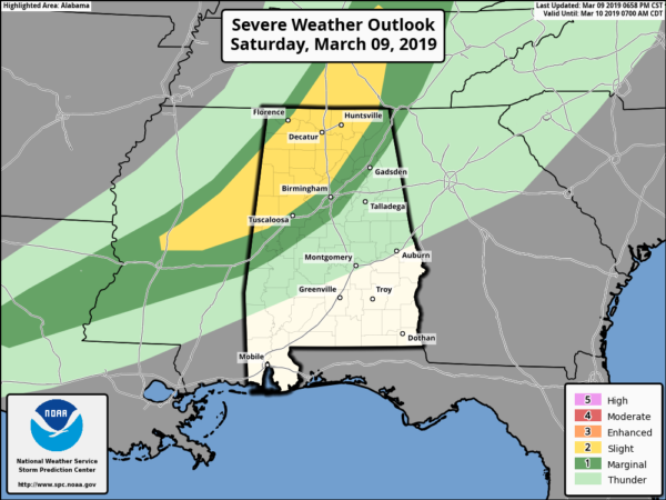
The latest update from the Storm Prediction Center has the Enhanced Risk for severe storms removed from the latest outlook graphic. This leaves a banana-shaped area defined in a Slight Risk, which includes cites east of a line from Vina to Lexington, to locations west of a line from Geiger to Northport to Kimberly to Scottsboro.
While the threats of severe storms continue to drop as we have lost the heating of the day and instability is settling down, we still have the potential for a few isolated damaging wind gusts up to 60 MPH and a brief tornado or two.
The main dynamics of the system are starting to pull away from North/Central Alabama, but we still have plenty of helicity in the northern parts of the area, maxing out at 450 m2s2. The only problem is that those higher helicity values are starting to become separated from the higher instability values, which really lowers the risk of severe storm development.
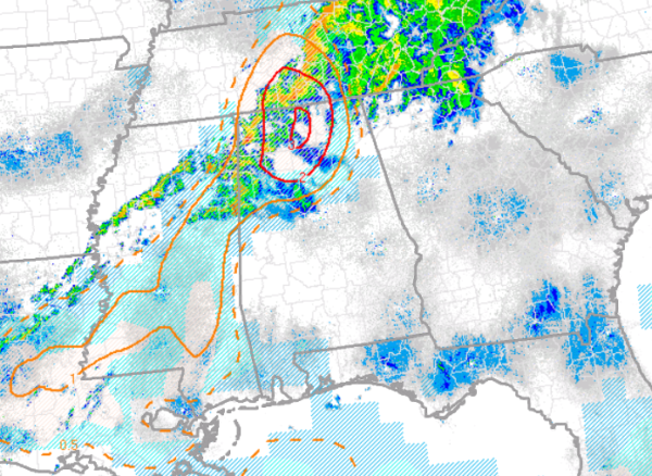
We still do have to watch a few locations very closely as we continue to have STP values in the 2.0 to 3.0 range over the north-central parts of North Alabama. This is where we could see the better chances of any tornadoes forming within the next hour or so. The HRRR continues to show those STP values dropping rapidly over the next couple of hours.
We now think that the timing for stronger to severe storms will be from now until midnight tonight, which will allow some of us to get some much-needed sleep. Remember, we lose an hour due to Daylight Saving Time occurring at 2:00 am Sunday and we move the clock ahead one hour.
Out ahead of the storms, we’ll continue to have some gusty pressure gradient winds. They may be strong enough to bring down some weaker trees, especially with the already-saturated soil.
Don’t let your guard down yet, we still have a little while longer to go. We’ll keep you updated.



