Fog Advisories For Parts Of The Area

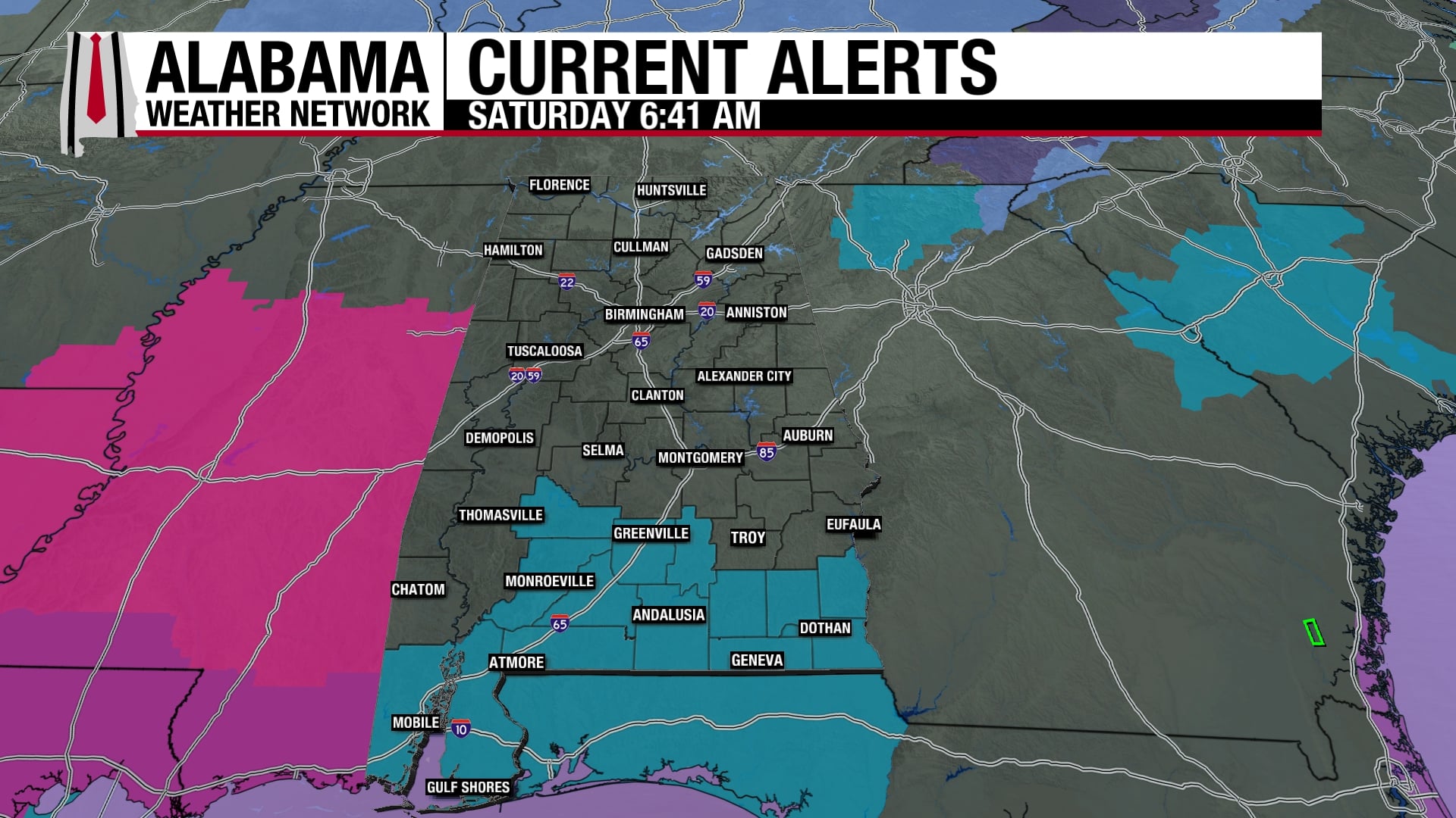
A Dense Fog Advisory is in effect for the eastern and southern counties of Central Alabama and is set to expire at 9:00 am.
A Dry And Very Nice Sunday
We’ll have mostly sunny skies through much of the daylight hours, but clouds will begin to move into the area out ahead of an approaching cold front. Rain chances will start to increase after midnight over the western parts of the area, so go out and enjoy the day while it is dry. Highs will be nice, reaching the lower to mid-60s for most, upper 60s for the extreme southwestern parts of the area.
Flood Watches Issued Ahead Of The Start Of The Big Rains
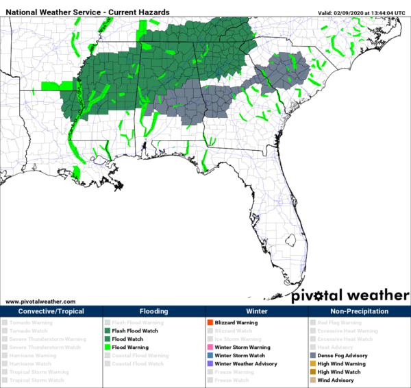
An Areal Flood Watch has been issued for all counties in North Alabama and for the northern and western counties in Central Alabama starting at 6:00 am on Monday morning and is set to expire at 6:00 am Tuesday morning at this point.
A Very Wet Start To The Work Week
The cold front will continue to make a very slow approach toward Central Alabama on Monday, as warm, moist, and unstable air will be pulled up into the area out ahead of it, setting the stage for rain and thunderstorms. Those will be likely over the western and northwestern parts of the area for the first half of the day and eventually moving into the rest of the area during the late afternoon hours. Rain could be heavy at times and some flash flooding issues are possible, especially with the already well-saturated soils. 1-3 inches of rainfall is possible across much of the area through midnight. Highs will be in the lower 60s to the lower 70s across the area.
On Tuesday, the front stalls out over Central Alabama and that will keep rain and a few thunderstorms likely across the area through much of the day. Another surface low will form out to the west of us that may allow some of the moisture to be pulled northward which may allow some locations south of I-20 to be rain-free for a few hours during the late-night and overnight hours. Rainfall totals through midnight look to be around 1-2 inches. Highs will be in the lower 60s to the mid-70s.
No Change For Wednesday & Early Thursday
The surface low will be located on the Gulf Coast near the Texas/Mexico border to start the day on Wednesday and will be moving northeastward along the front. The front will also start to move once again slowly and the rain and thunderstorms will become likely across the area during the second half of the day. We could see another 1/2 to 1-3/4 inches of rainfall through midnight. Highs will be in the lower 60s to the mid-70s across the area from northwest to southeast.
On Thursday, the system will finally catch high gear and will start to accelerate out of the area by or just after the midday hour, but another 3/4 to 1-3/4 inches of rainfall may occur before it exits, stage right. Skies will remain mostly cloudy and afternoon highs will reach the upper 50s to the upper 60s.
Valentine’s Day And The Start To The Weekend
Cupid must have worked some kind of deal with Mother Nature to allow Friday to be rain-free. We’ll finally have a chance to get to dry out a little as skies will slowly start to clear out during the day and will be mostly clear by sunset. Temperatures will be close to seasonal as highs will reach the lower 50s to the lower 60s across the area for northwest to southeast.
Saturday will be a pleasant start to the Central Alabama weekend, but the dry weather doesn’t last long as showers look to move in after midnight. Skies will be mostly clear through the daylight hours with clouds increasing during the night. Highs will be in the upper 50s to the lower 60s.
On This Day In Weather History
1990 – Thunderstorms developing ahead of a cold front erupted over eastern Texas late in the morning and produced severe weather as they swept across the southeastern states. Early evening thunderstorms spawned a tornado that injured one person at Nat TX and produced tennis balls size hail which caused more than half a million dollars damage around Shreveport LA.
NWS Birmingham SKYWARN Storm Spotter Training
The National Weather Service office in Birmingham will be offering several online Basic Spotter Courses and a single Advanced Spotter Course over the next few months. These online courses are FREE and are open to anyone who would like to learn more about what it takes to be a spotter and what to look for. More information can be found on the NWS Birmingham’s website, just CLICK HERE to visit the site.
Beach Forecast
Get the latest weather and rip current forecasts for the beaches from Bay St. Louis, MS, to Panama City Beach, FL, on our Beach Forecast Center page. There, you can select the forecast of the region that you are interested in.
Advertise With The Blog!
We had another fantastic year in 2019 with just over 17 million page views! That brings our total for the last 2 years close to 37 million page views! Don’t miss out! We can customize a creative, flexible, and affordable package that will suit your organization’s needs. Contact Bill Murray at (205) 687-0782.
E-Forecast
Get the Alabama Wx Weather Blog’s Seven-Day Forecast delivered directly to your inbox by email twice daily. It is the most detailed weather forecast available in Central Alabama. Subscribe here… It’s free!
Connect With The Blog On Social Media
You can find the AlabamaWx Weather Blog on the major social media networks:
Facebook
Twitter
Instagram
WeatherBrains
Don’t forget you can listen to our weekly 90 minute netcast anytime on the web at WeatherBrains.com or on Apple Podcasts, Stitcher, or Spotify. This is the show all about weather featuring many familiar voices, including the meteorologists at ABC 33/40.