


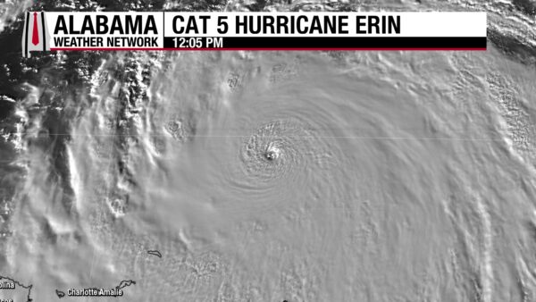
Erin roared from a Category 1 to an extremely powerful Category 5 overnight, now packing 160 mph winds with a recon-measured central pressure near 917 mb while passing north of the Leeward and Virgin Islands. The hurricane’s motion is almost due west—south of most model tracks—which matters because a stronger storm can “muscle” farther west before it feels the weakness that eventually turns it north and then northeast.
WHAT’S STEERING ERIN
A stout ridge north of the hurricane is the main driver of the westward track. A trough now over the Tennessee Valley should erode that ridge on its western side as it reaches the Southeast coast in the next 1–2 days. How quickly that weakness opens—and how much Erin resists it—will decide where the turn happens. A farther-west glide to around 72–75°W before the hook would bring Erin uncomfortably close to the Bahamas and later the North Carolina Outer Banks.
CURRENT & NEAR-TERM IMPACTS
Outer rainbands will keep sweeping the northern Leewards and the Virgin Islands today, reaching Puerto Rico and Hispaniola later with bursts of heavy rain, localized flooding, gusty squalls, and high surf. Hazardous seas extend well beyond the core.
BAHAMAS OUTLOOK
Guidance favors a track east of the islands Monday night–Tuesday, but a powerful Erin could pass within about 100 miles of the eastern/northern Bahamas—close enough for tropical-storm conditions and dangerous surf. How close is still tied to the timing of the turn.
U.S. EAST COAST (ESPECIALLY THE OUTER BANKS)
Ensembles still favor an offshore track Wednesday–Friday, but a stronger, farther-west Erin could come within roughly 100–150 miles of the Outer Banks. That would mean bands of heavy rain clipping far eastern North Carolina and the OBX with the potential for tropical-storm-force gusts; hurricane-force winds remain likely offshore. The bigger, more certain story is high surf, large swells, and dangerous rip currents up and down the East Coast.
BERMUDA
Erin should pass far enough west to avoid a direct hit, but outer bands and rough seas are possible mid-week.
ALABAMA & THE GULF
No Gulf threat from Erin. Our focus along the central Gulf Coast is routine summer storms; surf impacts here look limited compared to the Atlantic side.
WHY MODELS DISAGREE
The GFS tends to be farther east in part because it holds a weaker storm; the stronger European solutions lean farther west. Given Erin’s present intensity and expected staying power, those west-leaning tracks deserve attention until the turn is observed.
WHAT WE’RE WATCHING NEXT
• Signs of the northward bend and the longitude where it happens
• Strength trends (a stronger core tends to track a bit farther west)
• Any watches for the Bahamas and, later, the Outer Banks corridor
• Swell and rip-current risk along the entire U.S. East Coast
BEYOND ERIN: TWO WAVES IN THE FAR EASTERN ATLANTIC
Two tropical waves near and over Africa bear watching next week. Ensembles hint at a developing system over the central tropical Atlantic in the second half of the week, with the westernmost wave the one to watch for the Lesser Antilles late week. Details depend on each wave’s structure and whether Erin’s outflow introduces shear upstream.
Bottom line: Erin is a dangerous Category 5 today, tracking west of most model guidance. A turn to the north is still expected, but the exact timing controls how close Erin gets to the Bahamas and the North Carolina Outer Banks. Interests there should stay vigilant and track official updates.



