


Looking wistfully northward at storms in the Nashville area down through eastern Tennessee, but those are not destined to come our way. So no relief is in sight this afternoon.
Heat index values are well above 100F at nearly all locations across Alabama at this hour. The HIX reading at Birmingham is 106F, 106F at Anniston, and the HIX at Tuscaloosa is 110F.
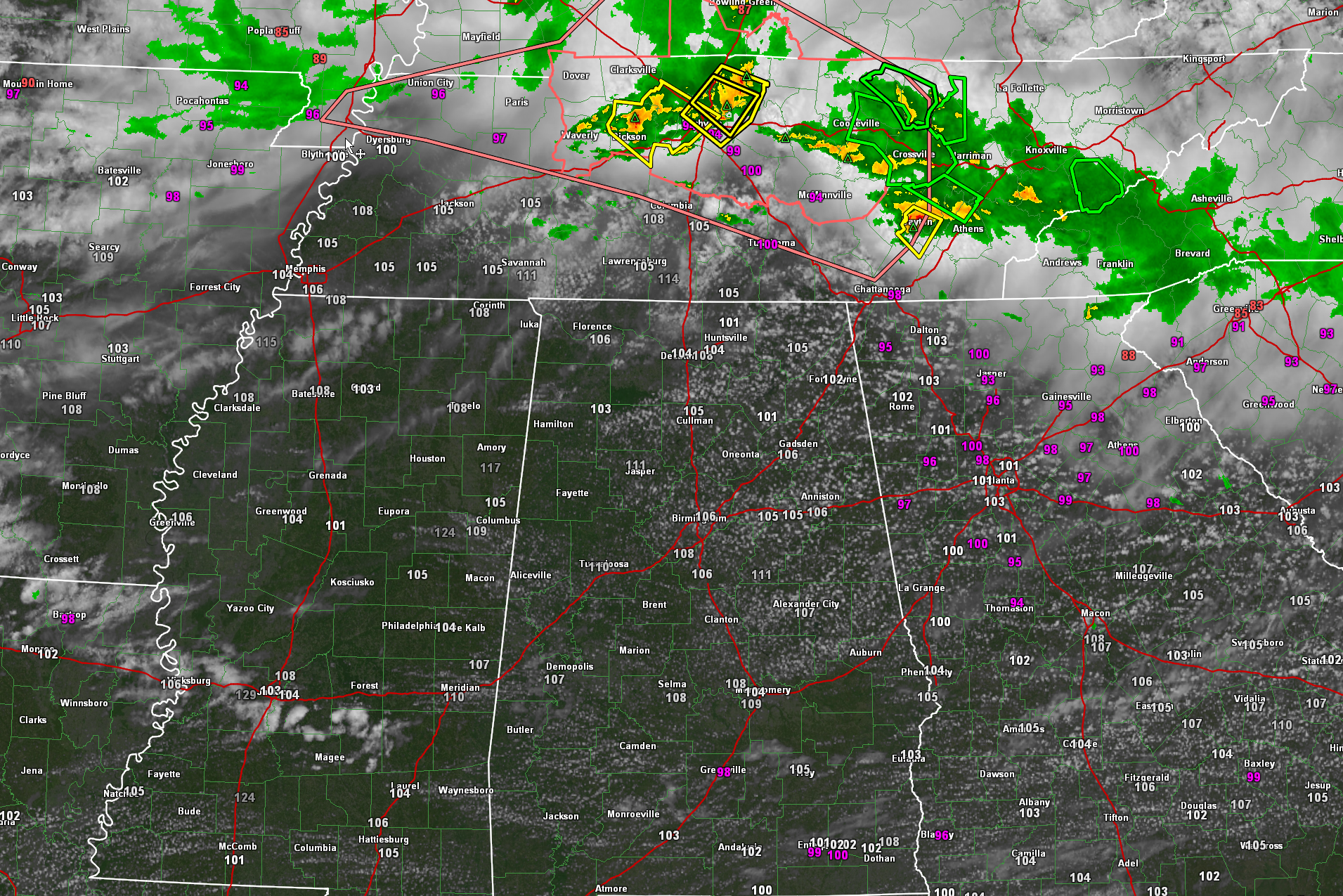
Those white hot values on the map are heat index readings.
The SPC does have the northeastern corner of the state outlook for a slight risk for severe weather today and tonight. The risk area includes places like Florence, Huntsville, Decatur, Fort Payne, and Gadsden.
The marginal risk extends down to Hamilton, Jasper, Birmingham, and Valley.
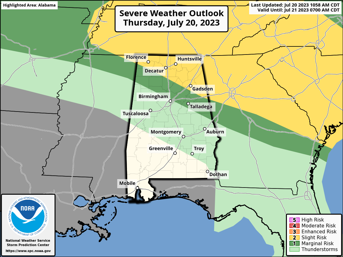
The main threat is damaging winds, although there is a small chance of hail and even a tornado.
Storms are expected to flirt with the northeast corner of the state this afternoon, with two rounds of potential storms through teh Tennessee valley overnight.
Looks like we might deal with a round of thunderstorms tomorrow afternoon that will be further south, through the I-22/US-280 Corridor.



