


Here are the current flash flood warnings for Alabama including the new one for Fayette, Pickens, Tuscaloosa, Walker and Winston Counties and the new one for Cullman County.
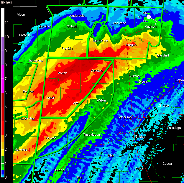
This Doppler radar product shows estimated rainfall totals over Northwest Alabama. You can see that some extremely heavy rains have already fallen and more rain is lined up to move across the warned areas with 1 to 2 inches per hour possible.
The good folks at NESDIS in Washington warn that the heaviest rain over the next three hours will be from Meridian MS to Tuscaloosa as an upper level disturbance rotates out of Louisiana, enhancing thunderstorms and training them into West Alabama. The line of thunderstorms has been moving east at a faster rate, but it may slow again in response to the approaching disturbance.
The flash flood watch continues until noon and has been expanded eastward to include Etowah and St. Clair Counties.



