


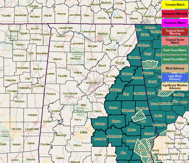
NWS Birmingham has issued a Flash Flood Watch for several counties in Central Alabama starting at 7:00 PM tonight and is set to expire on Thursday evening at 7:00 PM. The watch includes Autauga, Barbour, Bullock, Calhoun, Chambers, Cherokee, Clay, Cleburne, Coosa, Elmore, Lee, Lowndes, Macon, Montgomery, Pike, Randolph, Russell, Talladega, and Tallapoosa counties.
A steady stream of tropical moisture from the Gulf of Mexico and a series of upper-level disturbances will combine forces to bring a several day period of off-and-on stormy weather to Central Alabama. At this time, it looks like the area most likely to get repeated heavy rain from thunderstorms is in a band from the Montgomery and Troy areas, northward to Anniston/Oxford and Centre. Average rainfall amounts, through Thursday, in this area are expected to be between 2 and 3 inches. However, locations that get persistent thunderstorms could receive 4 or more inches of rain.



