


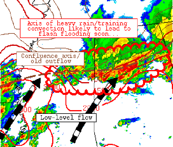
Summary… Axis of training convection will likely lead to flash flooding over the next 2-3 hours – especially in northern Alabama.
Discussion… Recent observational trends/radar mosaic indicate intensifying convection along a general axis from near Rome, Georgia to near Columbus, Mississippi, with mean storm motions generally parallel to the initiating boundary. Meanwhile, the upstream airmass (across western Mississippi) continues to destabilize ahead of another organizing MCS in northwestern Louisiana that should traverse the region over the next 2-3 hours or so. The presence of weak capping, strong instability, and sustained convergence along the boundary should continue to foster convective redevelopment from west to east across the discussion area over the next few hours, with flash flooding becoming and increasing concern as convective coverage increases. This threat should persist through at least 5 pm, and areas of 4+ inch rainfall totals per 3 hours cannot be ruled out.



