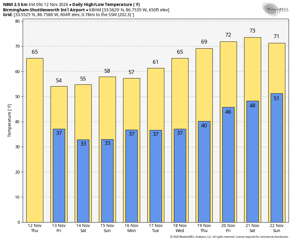
COLDER: The coldest air so far this season will roll into the Deep South today. Temperatures won’t get out of the 50s this afternoon for most of Alabama, and a freeze warning is in effect early tomorrow for the northern 2/3 of the state.
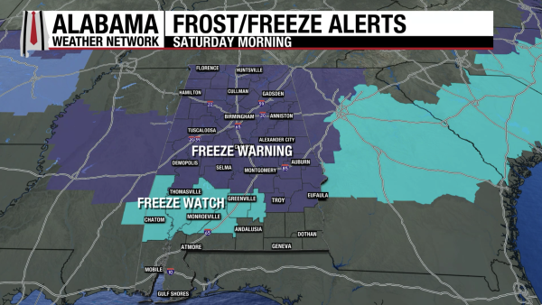
Temperatures dip into the 28-32 degree range where the freeze warning is in effect, and Sunday morning should be just as cold. The weekend will feature a sun filled sky both days with a high in the 50s tomorrow, followed by upper 50s and low 60s Sunday.
NEXT WEEK: A disturbance has potential to bring a few sprinkles to the southwest corner of Alabama Monday, but most of the state will stay rain-free. The rest of the week will be dry with a warming trend; temperatures reach the low 70s by Friday. It still looks like the next chance of meaningful rain will come at some point the week of Thanksgiving. See the video briefing for maps, graphics, and more details.

TROPICS: The Atlantic basin remains quiet and tropical storm formation is not expected through at least the next seven days. The season ends November 30.
FOOTBALL WEATHER: Auburn will travel to Starkville tomorrow to play Mississippi State (11:00a CT kickoff). Expect a sunny sky with temperatures rising from near 48 degrees at kickoff into the mid 50s by the end of the game.
Alabama will be in Nashville to take on Vanderbilt (11:45a CT kickoff). The sky will be sunny; temperatures will rise from near 47 at kickoff into the low 50s by the final whistle.
The weather will be cool and dry for all of the other games across the Deep South.
ON THIS DATE IN 1972: An F2 tornado moved through parts of Baldwin County; Rosinton Elementary School was damaged east of Loxley. The roof was removed from the gym. One barn was destroyed and several other buildings were damaged.
Look for the next video briefing here by 3:00 this afternoon… enjoy the day!