


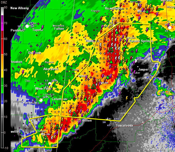
Doppler radar shows strong indications of severe wind moving into Walker County right now.
Look at the radar image above. See how the most intense echoes “bow” into Walker County? That shows powerful winds behind the bulge…
See the “S” looking pattern to the wave? That could be a small scale low pressure system that enhances the high wind potential as well…
Winds could be 80 mph! That can easily produce damage equivalent to that of a small tornado!
We will probably see lots of wind damage reports tonight…



