


Tropical Storm Gonzalo
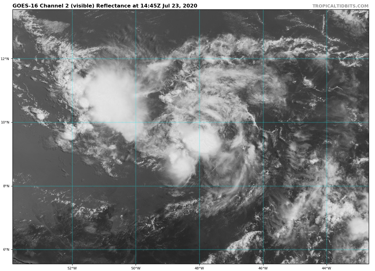
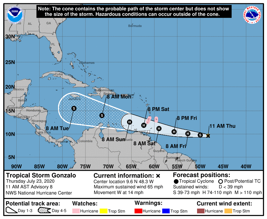
As of the 10:00 am update from the National Hurricane Center, Gonzalo was located about 885 miles to the east of the southern Windward Islands, and was moving to the west at 14 MPH. Maximum sustained winds were at 65 MPH and the minimum central pressure was down to 997 MB or 29.44 inches.
A Hurricane Watch has been issued for Barbados, and for St. Vincent and the Grenadines.
On the forecast track, the center of Gonzalo will approach the southern Windward Islands Friday night and move across the islands Saturday and Saturday evening. Some strengthening is forecast during the next couple of days, and Gonzalo could become a hurricane tonight or on Friday.
Gonzalo is a small storm, and tropical-storm-force winds extend outward up to 35 miles (55 km) from the center.
Hurricane conditions are possible within the watch area by Saturday afternoon, with tropical storm conditions possible by midday Saturday.
Gonzalo is expected to produce total rain accumulations of 2 to 5 inches, with isolated maximum amounts of 7 inches in Barbados and the Windward Islands from Friday night through Sunday night. Gonzalo is also expected to produce total rain accumulations of 1 to 2 inches in Trinidad and Tobago. Rainfall in Barbados and the Windward Islands could lead to life-threatening flash floods.



