


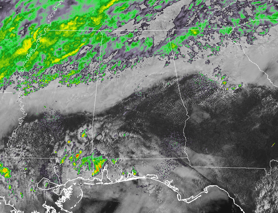
It may not be the best news at the moment, but it is much better than it has been over the past few days. Currently at 12:45 PM, we have scattered light showers over the north and northwestern parts of the state while only a couple of isolated stray showers south of the I-59 corridor. The heavier rainfall that is north of the surface boundary has now moved north and northwest of the state with the heaviest activity flowing over the northern parts of Mississippi into the western parts of Tennessee.
The southern parts of the area are actually pretty lucky as plenty of sunshine and well above normal temperatures are occurring. Temperatures across the area are in the mid-50s to the lower 80s, with Montgomery as the warm spot at 81 degrees. Several locations in the northern parts of Central Alabama were tied at 54 degrees as the cool spots.
The good news is that it now looks like the heaviest of the rainfall will stay north of the state focused around the boundary, but we could still see some scattered showers move across the area mainly north of the I-59 corridor. Rain chances will be 30% or less around and south of the I-20 corridor for the rest of the day and into tonight, while rain chances will be higher north of that, around 40-60% the farther north you go. Highs will reach the lower 60s to the lower 80s across the area from northwest to southeast.
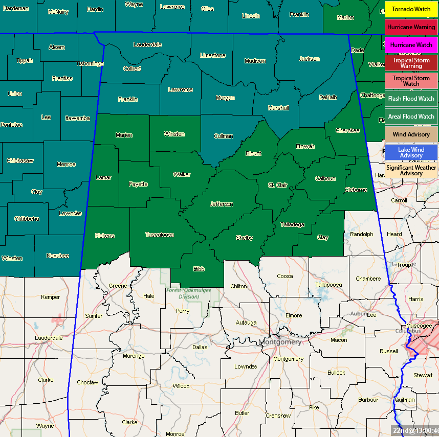
A Flash Flood Watch continues until 6:00 am tomorrow for all of the North Alabama counties, while an Areal Flood Watch continues until 6:00 am tomorrow for the northern half of Central Alabama.
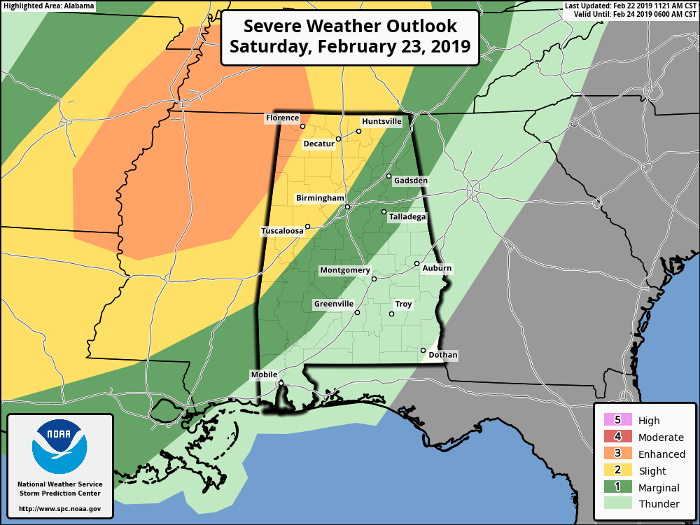
Now we can start to focus on the potential for severe weather late Saturday into the late night and overnight hours. The Storm Prediction Center has now moved the Enhanced Risk of severe storms more into the northwestern parts of the state, which now includes the cities of Detroit, Florence, Cherokee, and Red Bay. A Slight Risk for severe storms include the cities of Huntsville, Decatur, Cullman, Jasper, Hamilton, Haleyville, Birmingham, Fayette, Tuscaloosa, Eutaw, Livingston, and Cuba. A Marginal Risk for severe storms stretches as far east as Fruithurst to Rockford to Autaugaville.
All modes of severe weather will be possible across the risk areas… damaging winds in excess of 60 MPH, hail of 1 inch in diameter or greater, and a few tornadoes. The threats will lessen as you move from northwest to southeast, but cannot be ruled out even in the extreme eastern parts of the marginal risk area. Timing of the severe weather threat will start around 8:00 pm for the western parts of the area with the threat coming to an end around 3:00 am Sunday morning in the southeastern parts of the area.
The main focus will be if the line of storms will continue to keep its strength when it moves into the state. If it is stronger than forecast, then we’ll have the potential for a long-track tornado or two, mainly north of the I-59 corridor, and a larger threat of damaging winds and large hail. If it comes in weaker, all of the threats will be less but not zero.
Be sure and have your severe weather safety plan and supplies ready to go just in case your location goes under a severe thunderstorm or tornado warning. Have a dependable way of receiving your warnings, and have fresh batteries installed in your flashlights and in your weather radio. We’ll keep you updated on the blog throughout the rest of today and throughout Saturday.



