


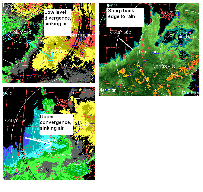
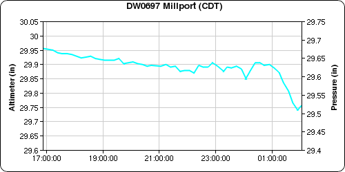
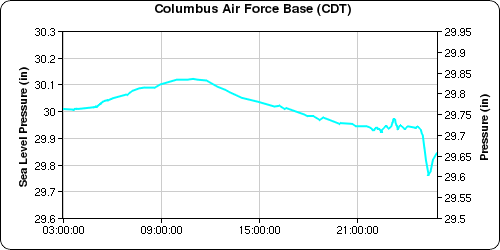
On nights like this with low-level stable air and elevated thunderstorms, we have to watch for wake lows and gravity waves at the back edge of rain areas. One may be forming, but it’s early to tell yet. The top left picture shows velocity from the Columbus, MS radar. Low-level divergence is shown over west Alabama. The lower right is velocity from BMX, showing a strong rear inflow jet behind the storms and convergence aloft. Both of these can create downward motion, drying and warming the atmosphere and creating low pressure. This low pressure causes winds to flow into it. It remains to be seen whether the winds will be significant, but pressures have already dropped pretty fast in eastern Mississippi and western Alabama.
Something to keep an eye on for central and east Alabama early this morning.



