


The system over the Central Gulf of Mexico has a circulation already as evidenced by the advanced scatterometer units aboard the EUMETSAT Metop satellites.
This image from earlier this morning shows the circulation with some winds in excess of 25 knots in the southeastern semicircle.
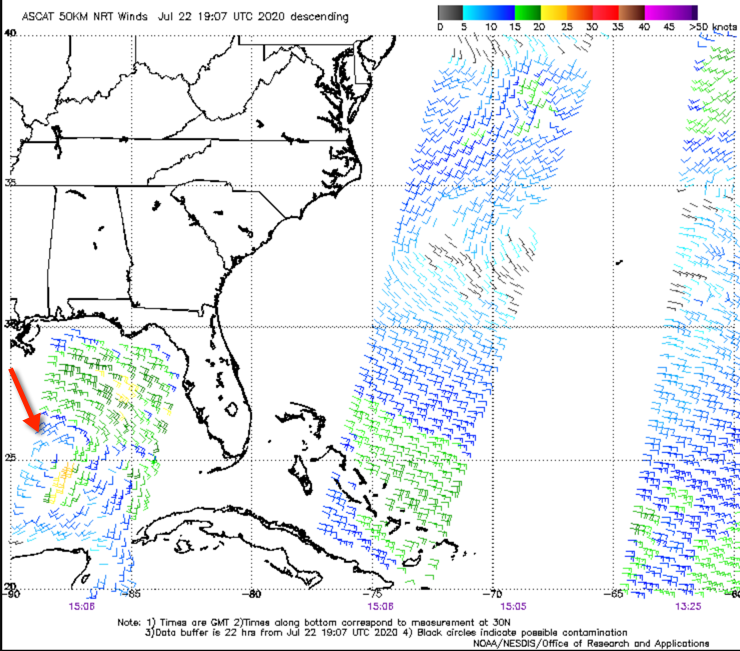
The question is whether it is well defined enough to be classified as a tropical depression coming up here at 4 p.m. I have a hunch that it may be.
Thunderstorms around the center have increased but are not well organized still. There is good divergence aloft, which should aid in intensification. Waters are warm ahead of the storm, running 28-30C. And wind shear will be decreasing to less than 10 knots as it moves northwestward. It will likely become a tropical depression later this afternoon or evening and become Tropical Storm Hanna by tomorrow.
It will move northwest reaching the Texas coast south of Houston on Friday, probably with 40-50 mph winds. It will have heavy rainfall as well, of course. Interestingly enough, some of the models strengthen it after it moves inland into Texas.
Showers and storms will impact the beautiful beaches of Alabama and Northwest Florida on Thursday and Friday. The rip current risk will be high through Friday night. Check out our new Beach Forecast Center here.



