


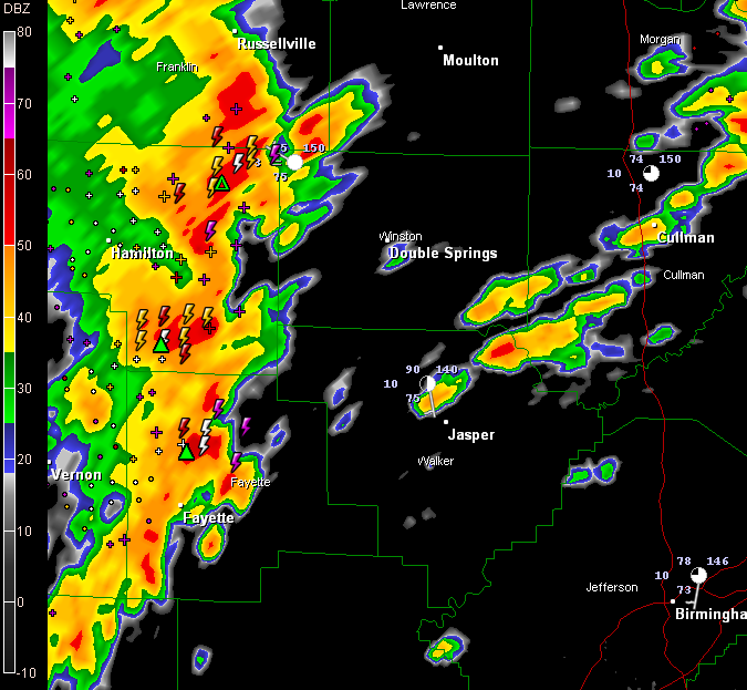
Strong thunderstorms are rolling across Marion and Lamar Counties now and will be in Walker and Winston Counties shortly.
They will pack quite a punch, although they are not severe. Expect strong gusty winds, intense lightning and torrential rains.
In addition, storms are developing now between Jasper and Cullman, about over Smith Lake. These storms will also become strong as they move northeast.
The airmass ahead of these storms is moist and moderately unstable and some storms will continue to become severe through the afternoon.
FOR THE BIRMINGHAM METRO
Storms now over Greene, Hale and Marengo Counties will continue to push northeast at 25 mph and will reach southwestern parts of the Birmingham metro area around 4:30. They should continue to slowly intensify and could be strong later this afternoon.



