


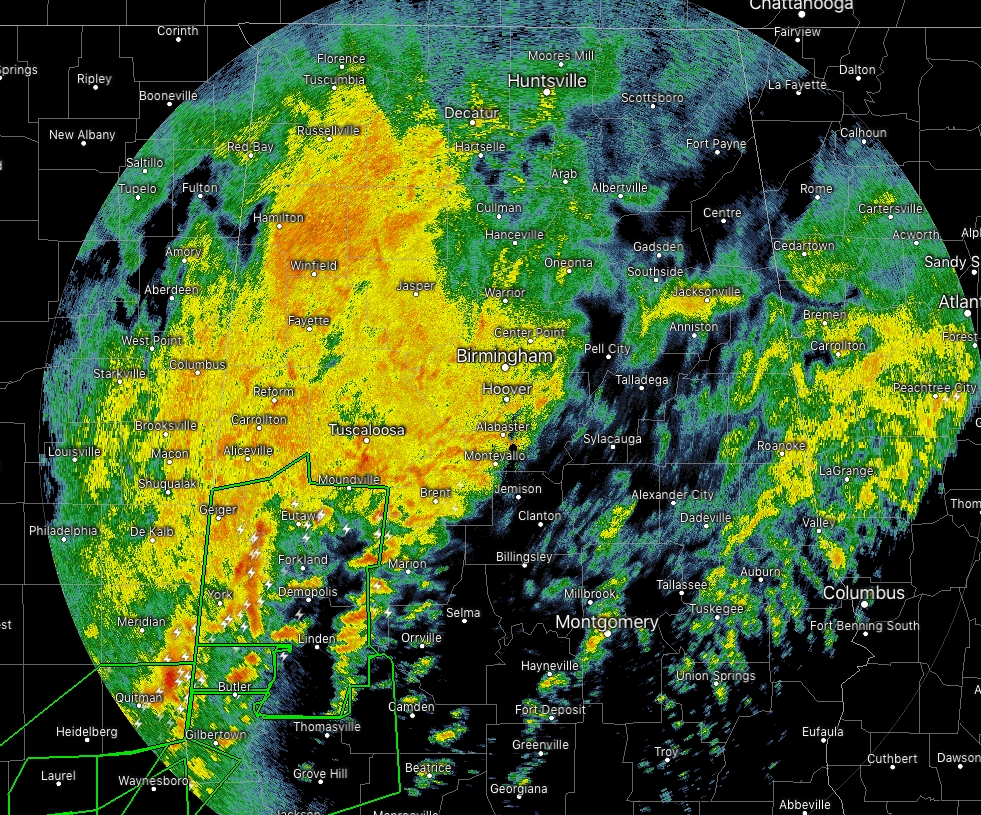
We continue to have moderate to heavier showers and thunderstorms over the western half of the state as we have flipped over into the 12:00 am hour on Friday. Rain has become more scattered over the eastern half of the state with really the heaviest shower on that side being over the cities of Ohatchee and Jacksonville.
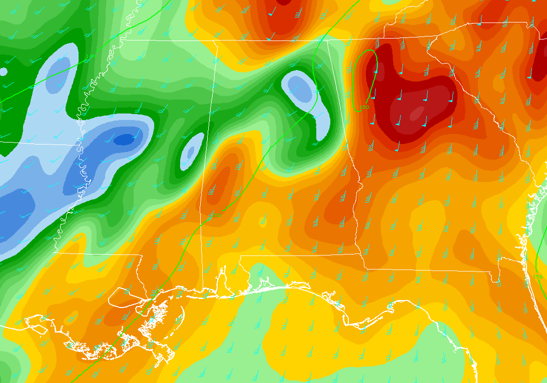
The reason why this is happening is the winds are stronger at the 5,000 ft level (850mb) from the south at around 50 knots and a little stronger, pulling more gulf moisture up from the south. Winds on that eastern side of the area are only around 15-25 knots.
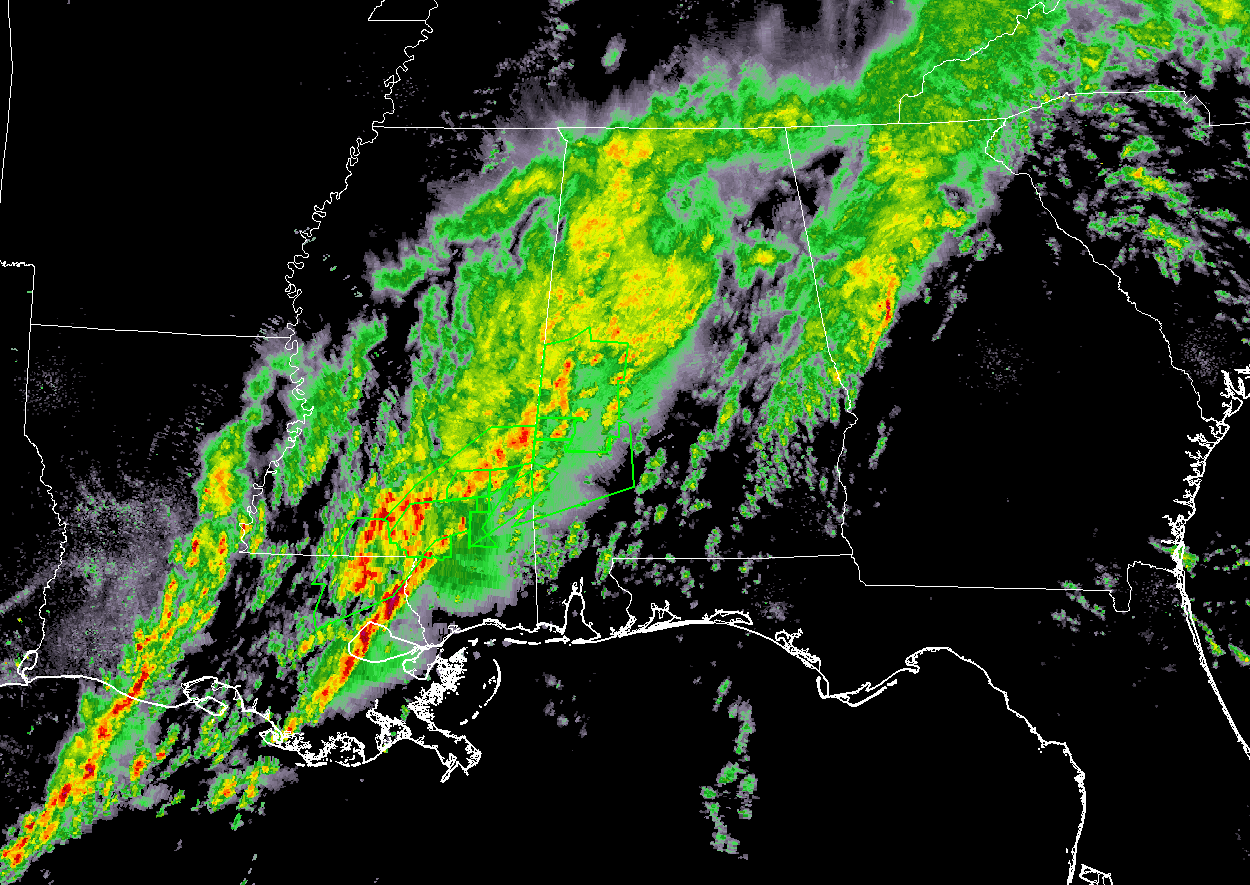
We continue to see more rain and thunderstorms forming back over the central parts of Louisiana and into the southern parts of Mississippi. Those will eventually move in our direction throughout the overnight and early morning hours today. Unfortunately, we could see another 1.00 to 2.00 inches across the area throughout the day, with localized heavier amounts possible where cell training occurs.
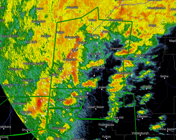
We haven’t had any real flooding issues throughout the day on Thursday up until 11:05 pm when NWS Birmingham issued a Flash Flood Warning for Marengo, Hale, Greene, and Sumter counties that is set to expire at 5:00 am Friday morning. The threat of flash flooding will be from the training of heavier cells continuously moving over the same areas. An additional 2.00 to 4.00 inches of rainfall is possible in the warning area.
Speaking of totals… On my personal CoCoRaHs rain gauge here at my house in northern Jefferson County, I have received a 24-hour rainfall total of 2.36 inches (from 12:00 am Thursday to 12:00 am Friday).
We’ll continue to keep you posted throughout the overnight and into the day.



