


Rain has been coming down in some places over western Alabama since midday yesterday, and it is not going to stop anytime soon. From Demopolis to Fayette to Cullman as much as 3 to 4 inches of rain have already come down, and we expect at the very least another inch or two before the rain slows down later this morning. Here is the latest storm total rainfall estimate from the Birmingham NEXRAD:
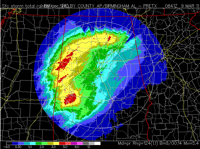
Storm Total Rainfall (Estimated) as of 2:45 AM
Sometimes it is useful to use satellite imagery to determine where precipitation is increasing the most. Colder cloud tops (brighter colors) indicate rapidly rising air and a strengthening region of precipitation. The circled area is expected to move across Central Alabama between 4 AM and Noon:
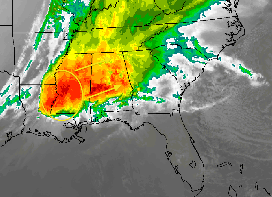
Infrared Satellite Image
This could easily bring a storm total of 4 to 7 inches of rain to some isolated spots, and that could cause life-threatening flooding to develop quickly this morning. As of right now, a number of counties west and north of Birmingham are under a Flash Flood Warning (Cullman, Winston, Marion, Lamar, Fayette, Walker, Tuscaloosa, Pickens, Madison, and Choctaw). The worst flooding usually occurs near the end of the event, so by sunrise and rush hour, we may start hearing of significant flooding problems around western Alabama and parts of the Birmingham metro area. Be alert, and do not drive through water that is flowing over a road. Fast-flowing water can sweep a car off the highway quickly, and there is very little that can be done to stop it other than simply avoiding the area.
There is still a small threat of a few strong or severe storms, but the greatest threat is near and south of US 80 through early afternoon. A tornado watch is in effect for southwestern Alabama until 8 AM, but it is mainly rain & thunder for Central and North Alabama.
Good Morning Alabama starts at 4:30; we will be on with any flooding developments as soon as we are aware of them.
-Jason
Follow me on Twitter: @simpson3340



