


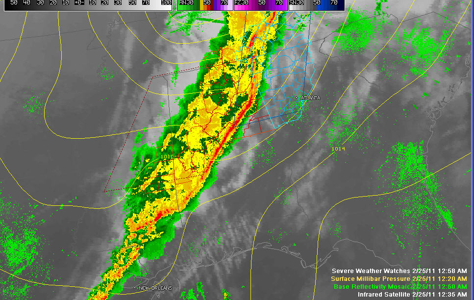
The intense line of thunderstorms is pushing east quickly tonight. It is east of I-59 now.
A tornado warning continues for southern Cherokee Counties. Etowah County has been cleared from the warning.
Rotation is shown on radar and a funnel cloud is reported near Hokes Bluff. It will be passing between Centre and Piedmont.
Severe thunderstorm warnings continue all ahead of the line for the potential for damaging winds.
Widespread tree and power line damage is reported across Central and North Alabama.
The line is near Jacksonville…it will be passing through Anniston and Oxford shortly.
The line is intense from Lincoln to east of Pell City to Vincent/Harpersville to just west of Wilsonville and Columbiana to east of Calera to west of Maplesville and to east of Marion and Uniontown.
It is moving east at 60 mph.
The line has weakened a bit.
The severe weather trheat is over for places like Gadsgde, Cullman, Birmingham, Tuscaloosa, Jasper and Fayette Counties.
The tornado watch continues for Cherokee, Calhoun, Cleburne, Talladega, Shelby, Clay and Randolph Counties until 2 a.m.
Alabama Power reports 16,000 people without power in West Alabama and 13,600 in the Birmingham area.
JB reports complete power failure his location in northeast Trussville.



