


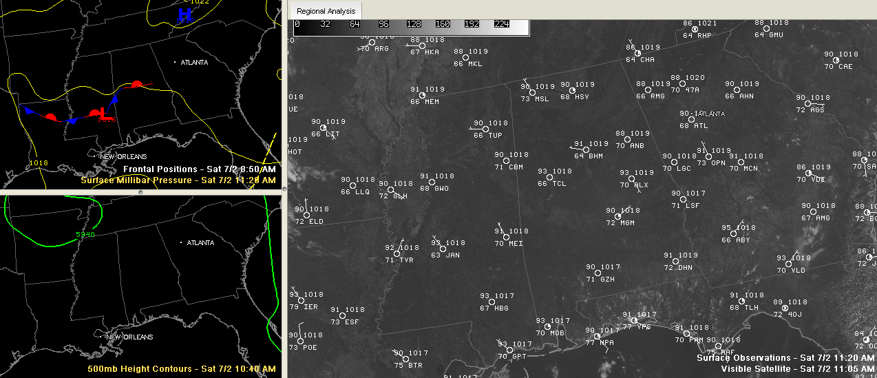
Looking for clues on the weather maps across the Southeast on this first Saturday in July.
We find a weak frontal boundary across Central Alabama, with a weak surface low west of Meridian.
High pressure over the Blue Ridge Mountains of Virginia and West Virginia was ridging down into Northeast Alabama, accompanied by some slightly drier air.
The airmass over East Central and South Alabama, from about Alex City south and southwestward contains more moisture, indicated by higher dewpoints.
There was a weak northerly flow aloft that had spread some patchy high clouds across part of East Alabama earlier today but for the most part, skies were clear through the morning.
Some cumulus clouds formed by late morning. They were more plentiful the further south you went.
Temperatures were soaring toward the mid and upper 90s once again in most spots.
Storms will form again this afternoon across the southern parts of East Central Alabama down into southeastern sections of the state. The best chances are in places like Alexander City, Montgomery, Troy and Auburn. Some of them could be on the strong side again with damaging winds and decent hail. Lookout for the intense lightning as well.
So the lucky folks southeast of Birmingham will get a cooling shower. The unlucky folks could get 70 mph wind gusts. Most folks will just be partly cloudy and hot.



