


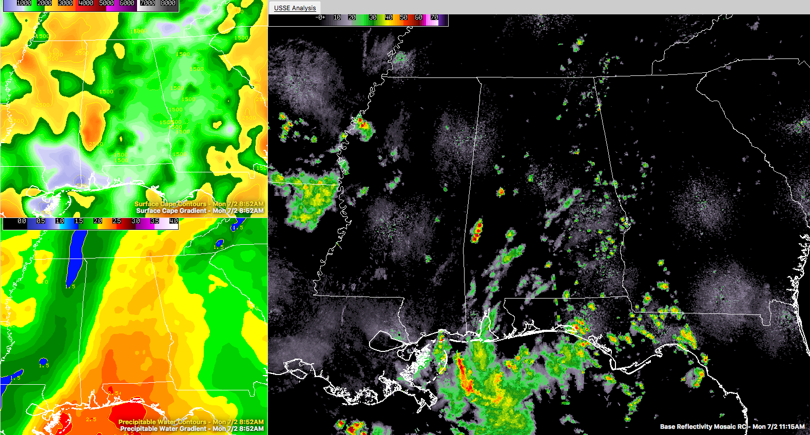
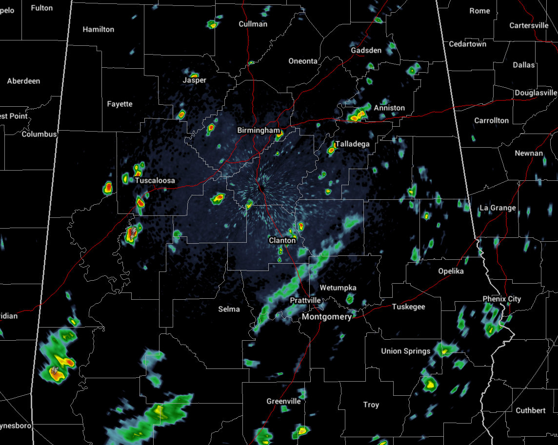
CONDITIONS ACROSS CENTRAL ALABAMA AT 11:30 AM
As of right now, the higher instability values are located over the western and southwestern parts of the area, where CAPE values are over 2500 J/kg. Radar shows that the most scattered shower and thunderstorm activity has blossomed over parts of Hale, Bibb, Perry, and Sumter counties. More showers are popping up elsewhere across the area as instability values are starting to increase with the heating of the day. There is plenty of moisture in the atmosphere as well, as precipitable water values are running in the 1.6-2.1 inch range.
Temperatures are running in the lower 80s to near 90 degrees throughout the area, and with dewpoints in the 73-76 degree range, heat index values are already up in the 90-99 degree range.
WEATHER FOR THE REMAINDER OF YOUR MONDAY
It will continue to be hot and humid throughout the rest of the day with mostly cloudy skies and a good chance of scattered to numerous showers and thunderstorms. Some of these storms may be strong with gusty winds up to 40 MPH, very heavy rainfall, some small hail, and plenty of dangerous cloud-to-ground lightning. Afternoon highs should top out in the upper 80s to the lower 90s across the area. The best coverage of storms will be during the afternoon and early evening hours. For tonight, skies will be mostly cloudy with most of the shower and thunderstorm activity coming to an end by the late night hours. Don’t be surprised if a shower or two linger on into the overnight hours. Lows will be in the lower to mid-70s.
DRIER AND HOTTER FOR TUESDAY
Tomorrow is my oldest daughter’s 16th birthday (Happy Birthday, Charlotte!!!) and I’m glad that we are celebrating indoors in a well air conditioned facility. Tuesday will be hot, hot, hot! Skies throughout the day will be partly cloudy and we’ll only have a slight chance of an isolated afternoon shower or storm throughout much of the area, while a few scattered storms are possible in the southwest corner of Central Alabama (Geiger to Demopolis to Minter and points south). Afternoon highs will reach the lower to mid-90s, while one or two locations may hit the upper 90s. Skies will become mostly clear for the late night and overnight hours, with a very small risk of a shower or two over the southeastern corner of the area. Lows will be in the lower to mid-70s.
AN UPDATE ON THE TROPICS
Everything remains rather quiet across the Atlantic Basin, and no new tropical cyclones are expected to form within the next 5 days in the Atlantic Ocean, Gulf of Mexico, or the Caribbean Sea.
ON THIS DAY IN WEATHER HISTORY
1833 – An unusually large New England tornado, one half to three quarters of a mile wide, went from Salem Pond to Norton Pond, VT, and then into Canada. It prostrated nearly everything in its path.
1843 – An alligator reportedly fell from the sky onto Anson Street in Charleston, SC, during a thunderstorm.
BEACH FORECAST CENTER
Get the latest weather and rip current forecasts for the beaches from Fort Morgan to Panama City on our Beach Forecast Center page. There, you can select the forecast of the region that you are interested in.
WE’RE HAVING A RECORD-BREAKING YEAR… BE SEEN WITH ALABAMAWX.COM!
Don’t miss out! We have enjoyed over 11.6 MILLION page views on AlabamaWx.com since the start of 2018. We can customize a creative, flexible and affordable package that will suit your organization’s needs. Contact Bill Murray at (205) 687-0782.
E-FORECAST
Get the AlabamaWx Weather Blog’s Seven-Day Forecast delivered directly to your inbox by email twice daily. It is the most detailed weather forecast available in Central Alabama. Subscribe here… It’s free!
WEATHERBRAINS
Don’t forget you can listen to our weekly 90 minute netcast anytime on the web at WeatherBrains.com or on iTunes. This is the show all about weather featuring many familiar voices, including the meteorologists at ABC 33/40.



