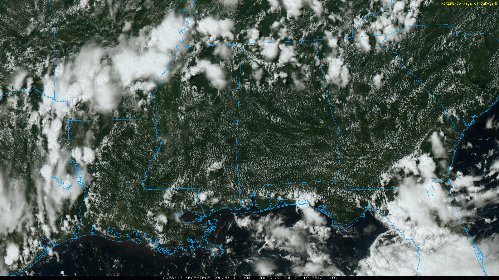
RADAR CHECK: Most of the scattered showers and thunderstorms across Alabama this afternoon so far have been north of I-20, over the northern third of the state. Some spots have received heavy amounts of rain with temperatures dropping into the 70s, but where the sun is shining we are seeing low to mid 90s, very close to seasonal averages. Scattered storms will end later tonight as the air cools and becomes more stable.
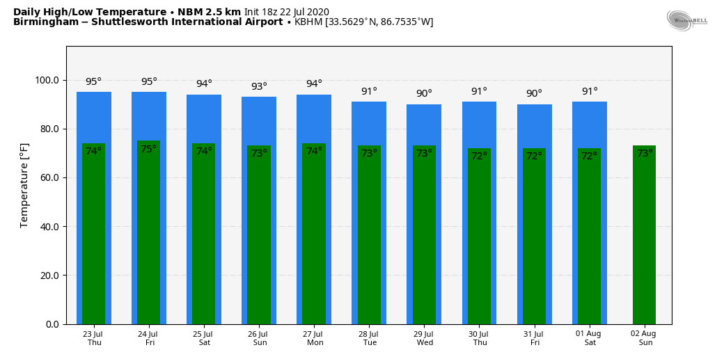
TOMORROW THROUGH THE WEEKEND: Classic summer weather continues across Alabama with partly sunny, hot, humid days and the daily round of “scattered, mostly afternoon and evening showers and thunderstorms”. Odds of any one spot getting wet will be in the 20/30 percent range each afternoon with highs generally in the 91-95 degree range. Just what you expect in late July in Alabama.
NEXT WEEK: Not much change Monday, but we do expect an increase in the number of showers and thunderstorms on Tuesday and Wednesday as moisture levels rise and the air becomes more unstable. See the Weather Xtreme video for maps, graphics, and more details.
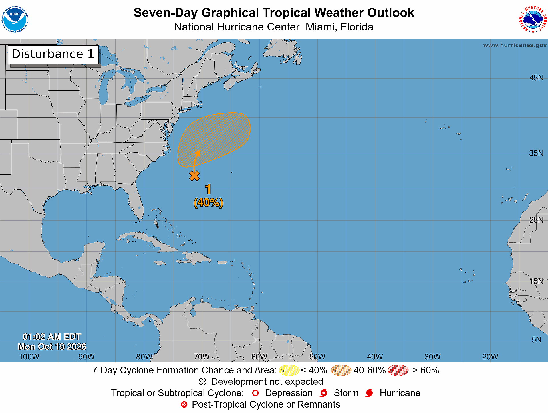
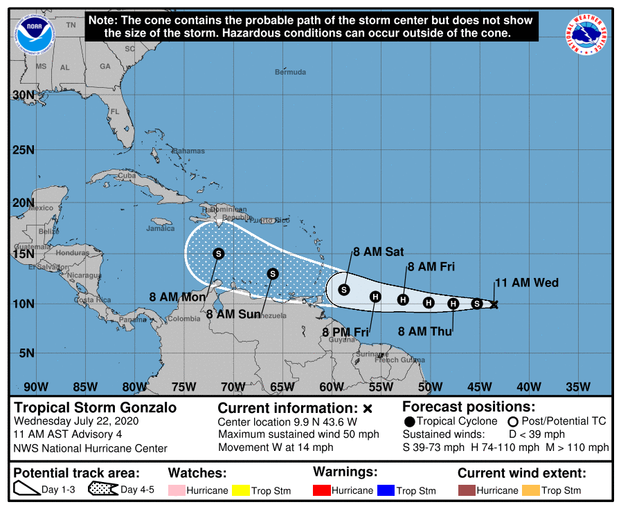
TROPICS: Tropical Storm Gonzalo is packing sustained winds of 50 mph, and is about 1200 miles east of the Windward Islands in the open Atlantic. It is expected to become a hurricane tomorrow, followed by some weakening back to tropical storm strength by the weekend as it moves through the islands and into the Caribbean. The small size of this system makes it susceptible to significant fluctuations in intensity, both upward and downward, over the next week. Most global models are now suggesting the system will survive an environment of dry air and subsidence, and there is a chance it enters the Gulf of Mexico in a week or so. Still a long way away, and just something to keep an eye on for now.
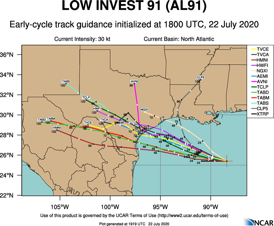
Closer to home, a tropical wave in the central Gulf of Mexico is expected to become Tropical Depression 8 over the next 24 hours; it is headed for Texas with potential for beneficial rain over the southern half of the Lone Star State in 4-8 days. No direct impact on the Central Gulf Coast (Gulf Shores to Panama City Beach) other than increased rip current danger tomorrow and Friday.
The rest of the Atlantic basin is quiet for now.
BIG SHAKER: A major, magnitude 7.8 struck off the southeast coast of the Alaskan peninsula early this morning. The quake, whose focus was at a depth of six miles, prompted the US National Tsunami Warning Center to issue a tsunami warning for the region, but it has been cancelled.
ON THIS DATE IN 1988: Dust devils are not a unique phenomenon, but usually they stay minimal. This was not the case in Dickinson County, Iowa where a powerful dust devil developed on the edge of Lake Okoboji. It picked up whole sections of several docks and swept away all of the loose dirt in the area. Estimated winds exceeded 60 mph.
BEACH FORECAST: Click here to see the AlabamaWx Beach Forecast Center page.
WEATHER BRAINS: Don’t forget you can listen to our weekly 90 minute show anytime on your favorite podcast app. This is the show all about weather featuring many familiar voices, including our meteorologists here at ABC 33/40.
CONNECT: You can find me on all of the major social networks…
Facebook
Twitter
Instagram
Pinterest
Snapchat: spannwx
Look for the next Weather Xtreme video here by 7:00 a.m. tomorrow…