


Daily Weather Briefing
June 28, 2026
ALABAMA THIS MORNING
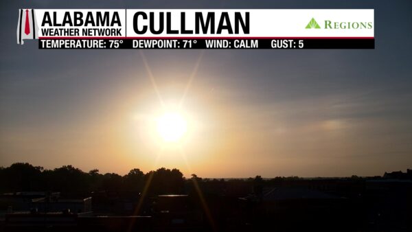
Skies are mostly clear this morning, and temperatures are in the low to upper 70s statewide. Those already warm temperatures signal the hot day we have ahead. It’s muggy out there as well, as dewpoints have climbed into the low to mid 70s.
ALABAMA 7 DAY FORECAST
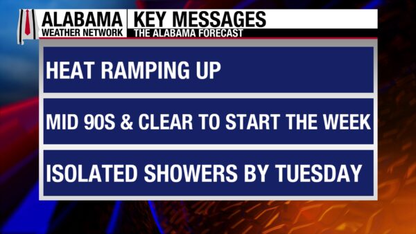
Today marks the real start of a heatwave that will impact the Southeast this week. Highs will reach the 90s over the next seven days as strong upper-level ridge and high-pressure have burrowed into the region. Rain chances stay low statewide this week.
HOT SUNDAY – June 28
Today will be hot as skies will be mostly clear, and rain chances are only 10% in the northern half of the state and zero in the southern half. The absence of rain and clouds will allow temperatures to rise to the low to mid 90s statewide. Despite the very small rain chance, the air is not lacking in moisture content. The humidity will be high and feels-like temperatures will rise into the upper 90s and mid 100s statewide! North Alabama is under a Heat Advisory until Tuesday.
HEAT CONTINUES MONDAY – June 29
Monday will be even hotter than today. The entire state will be rain-free, although clouds return in the late morning this dissipate in the afternoon. Highs will again reach the low to mid 90s, with the spread of 90s increasing some. Heat indices (feels-like temperatures) will hit the upper 90 to mid 100 range, although the upper 90s will be harder to find, and the 100s will be more widespread.
RAIN RETURNS TUESDAY – June 30
Sunday and Monday will have us grateful for showers and thunderstorms to come back to the region. A storm system will move unusually from the east to the west Tuesday afternoon bringing thunderstorms. Their main focus will be the south, but the north will see some scattered showers. A few cells may pack a punch with frequent lightning and heavy rain, but no severe weather is expected as of now. Highs will not be limited by the rain, and reach the low to mid 90s across Alabama, and encroach upon the upper 90s in the north. Feels-like temperatures? You guessed it- mostly in the 100s.
SLIGHTLY LESS HOT IN THE SOUTH WEDNESDAY – July 1
Originally, the title was going to be “Slightly Cooler…”, but the low 90s cannot be described as “cool”. The storm system will just bring south Alabama’s highs down from the mid 90s to the low 90s Wednesday. The northern half of the state will still easily hit the mid 90s, and the upper 90s will not be out of the question. The possibility of slightly drier air is present in the state as well, so feels-like temperatures may be subdued some. Regardless, it’ll still be hot Wednesday, and rain chances will be 10% in the northern half of the state and 30% in the southern half.
HOT END TO THE WEEK – July 2-4
The heat will be relentless toward the end of the week and into the holiday weekend. Rain chances will be driven by afternoon daytime heating, so they sit between 10 and 30% each day statewide.
Highs on Thursday will range from the mid 90s north to the low 90s south; heat indices will reach the upper 90s to mid 100s.
To start the holiday weekend, Friday’s highs will span from the mid 90s to low 90s from north to south, and the heat indices will be similar to the rest of the week’s.
The Fourth of July will be a hot one! The low to mid 90s will persist and the feels-like temperatures will, once again, range from the upper 90s to mid 100s.
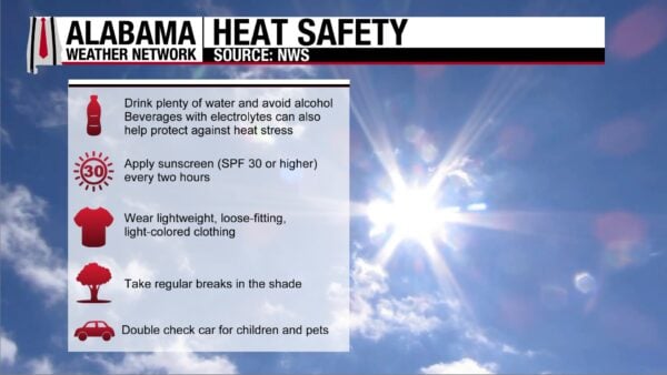
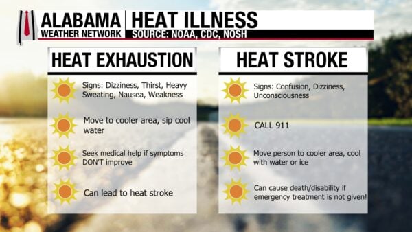
With the holiday coming up, more people will be spending time outdoors. Whether you’re outside all day, every day, or you have fun outdoor plans this week, please remember to stay hydrated and seek breaks in the shade and/or A/C as frequently as possible. More heat safety tips are above. Oh, and don’t forget to wear sunscreen!
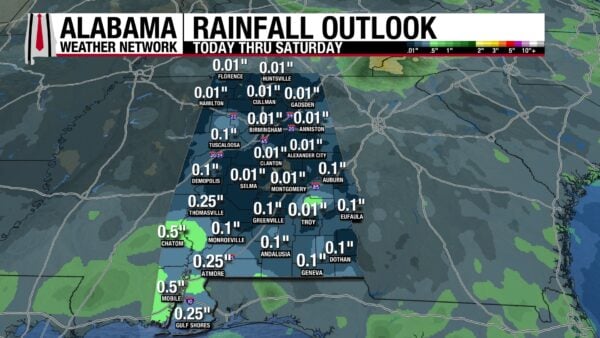
RAINFALL OUTLOOK
It’ll be dry! Most of the state will only receive 0.01 to 0.1 inches of rain through Saturday. South Alabama could see up to a half an inch, with most of it expected to fall Tuesday.
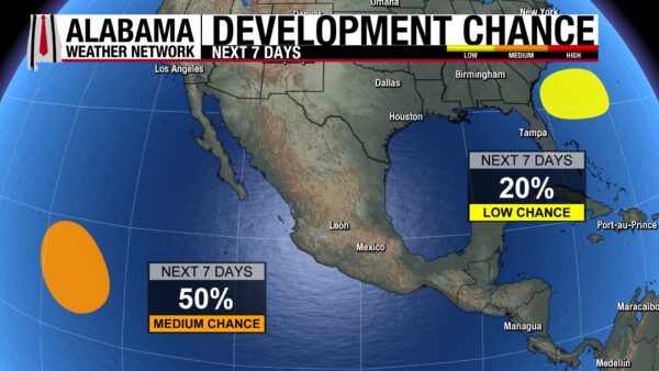
WATCHING THE TROPICS
The area of interest in the Atlantic still has a 20% chance of development into a tropical system by sometime this week. We are watching it closely. The area of interest in the Pacific clings to its 50% chance of development and will form into a tropical depression by mid-week this week if at all.
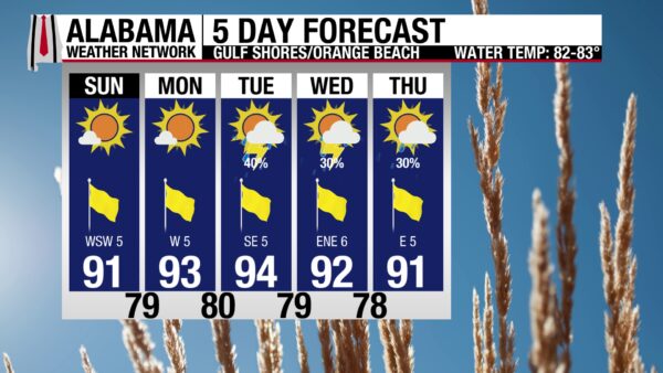
A FEW MORE RAIN-FREE DAYS AT THE BEACH
Today and tomorrow are the last rain-free days we’re expecting on the coast for the week. Then rain chances ramp up toward mid-week. Today, the high will hit the low 90s, skies will be sunny, the UV Index will be Extreme (wear sunscreen!), and winds will be from the southwest at 5 mph. Enjoy the water today, the rip current risk is low and the surf height is at 1 foot.
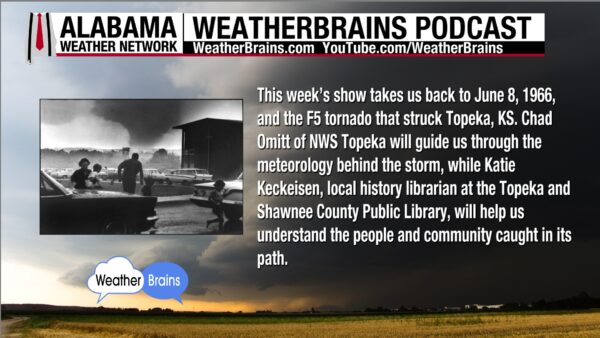
WEATHERBRAINS 1067
On tomorrow’s WeatherBrains episode, Chad Omitt and Katie Keckeisen will give us the science and human story behind the F5 Topeka, Kansas tornado that struck on June 8, 1966. Catch the episode wherever you listen to podcast or watch it HERE.
TODAY IN WEATHER HISTORY
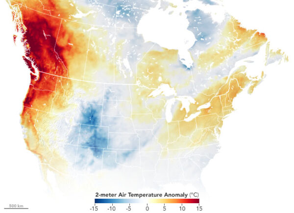
June 28, 2021 – The Heat Dome
By June 28, 2021, the Pacific Northwest was in the grip of a heat wave so extreme that old records were not simply broken. They were overwhelmed. A massive ridge of high pressure, often called a heat dome, settled over the region and trapped sinking, warming air over Oregon, Washington and British Columbia. Downsloping winds helped limit the cooling marine layer to the immediate coastline, allowing inland cities more accustomed to mild summer heat to climb into territory more familiar to the desert Southwest.
Portland, Oregon reached 116°F at the airport, setting an all-time record for the city just one day after reaching 112°F, which itself had been an all-time record. The National Weather Service in Portland noted that several locations had broken their all-time highs on Sunday, only to surpass them again on Monday. Downtown Portland reached 114°F, Troutdale reached 116°F, Vancouver, Washington reached 115°F, and Hillsboro and McMinnville each reached 114°F. These were not daily records. They were the highest temperatures ever observed at those locations.
The heat was just as astonishing farther north. Seattle reached 108°F, also an all-time record, after recording its first-ever streak of 3 consecutive 100-degree days. Before that heat wave, Seattle had never recorded even 2 consecutive days at or above 100°F. Farther south in the Willamette Valley, Salem reached 117°F, becoming the hottest temperature documented west of the Cascades in the Pacific Northwest. Across the Canadian border, Lytton, British Columbia reached 118.2°F that day, a Canadian national record that would be surpassed again the next afternoon.
What made the event so dangerous was not only the numbers, but the setting. Many homes in western Oregon and Washington were not built with extreme heat in mind, and air conditioning was far less common than in hotter parts of the country. Overnight temperatures stayed unusually warm, limiting the body’s ability to recover. Roads buckled, power demand surged, transit systems struggled, and emergency services were stretched as heat illness calls rose across the region.
The 2021 Pacific Northwest heat dome became one of the clearest modern examples of heat as a high-impact weather disaster. It showed that record heat can be deadly even without wind, flooding or lightning, especially when it strikes places where buildings, infrastructure and daily routines are not prepared for it. For Portland, Seattle, Salem, Lytton and many smaller communities, June 28 was not just a hot day. It was the day the upper limits of local heat history were rewritten.
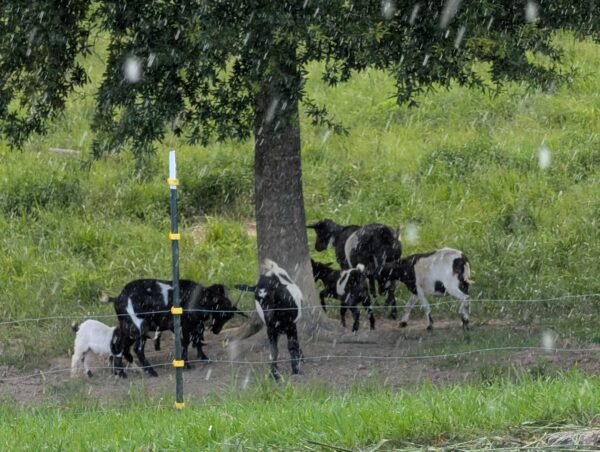
IMAGE OF THE DAY
Skywatcher Brian Parton sent in this picture of goats trying to shelter from quick pop-up shower in between Pell City and Anniston yesterday morning!



