


Our weather around here will be pretty interesting in the 7-10 day time frame. Bitterly cold air will invade the western and northern U.S. in coming days, with temperatures as in the -30s over parts of Montana and North Dakota. Many record lows, most likely, will be established.
The leading edge of the cold air will just creep into Alabama late this week and over the weekend. The air will be very shallow, only a few thousand feet deep. Below are forecast temperatures for late Sunday night (December 8)…
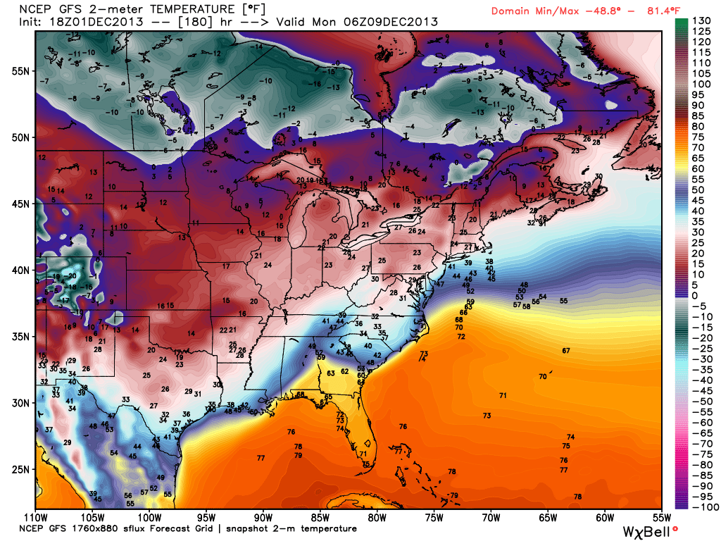
The GFS is suggesting temperatures will be below freezing over the northwest corner of the state. And, the model probably doesn’t have the resolution to handle the shallow cold air, and I fully expect it to be pretty cold down to the I-20/59 corridor.
On top of the shallow cold air, a disturbed southwest flow aloft will continue…
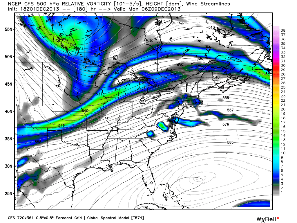
This will put moisture up and over the cold air, leading to clouds and precipitation. Below is the forecast precipitation type Sunday night…

This is suggesting freezing rain and possible ice accumulation over North Mississippi and West Tennessee, but not over Alabama.
The models will have a very hard time with this pattern, and we probably won’t now for a few days if ice will be a possibility in Alabama, but I sure can’t rule it out based on the historical results in this kind of setup.
So, while we warm into the low 70s by Wednesday and Thursday, look for much colder air by Friday and the weekend, with some potential for winter mischief, especially over Northwest Alabama. Stay tuned.



