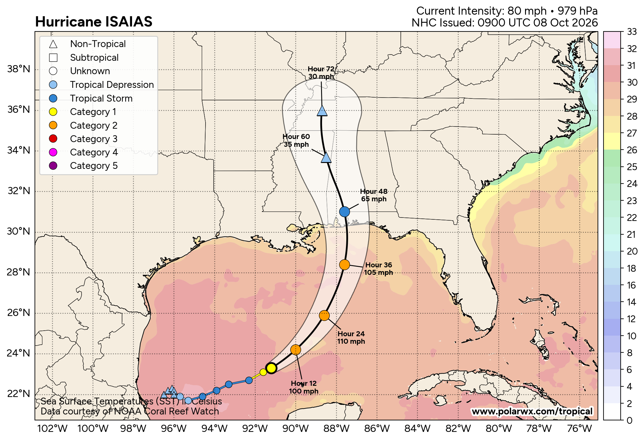
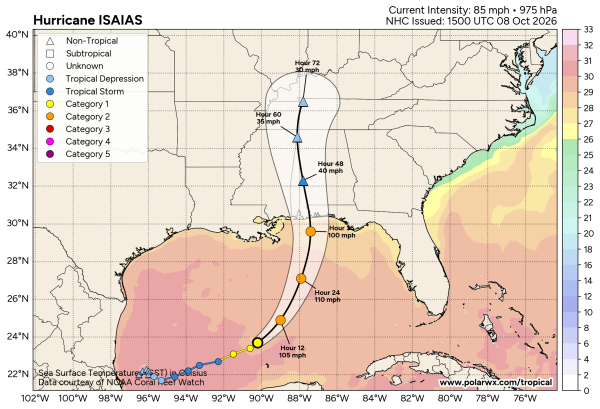
ISAIAS THIS AFTERNOON: At mid-afternoon Hurricane Isaias is packing sustained winds of 85 mph, and it is about 325 miles south of the mouth of the Mississippi River. The system is moving to the east/northeast at 10 mph. Landfall will come late tomorrow night near Perdido Key (between Pensacola Beach and Orange Beach) with winds of around 90-100 mph.
Here are the key messages…
*Isaias is expected to remain a dangerous hurricane through landfall, and gusty winds are expected well inland after landfall given the anticipated expansion of the wind field and accelerating forward speed of the storm. Long-duration power outages are possible along the coast, the Florida Panhandle, and inland parts of Alabama. Wind gusts to 50 mph are possible across Alabama Saturday morning. Highest winds along the coast will come from 6:00 p.m. tomorrow through 6:00 a.m. Saturday. Highest winds for inland parts of Alabama will be generally from 3:00 a.m. until 6:00 p.m. Saturday.
*A tropical storm watch has been issued as far north as I-20, and a high wind watch is in effect for the northern third of the state. Flash flood watches also cover most of the state, and of course a hurricane warning is in effect for the Alabama coast.
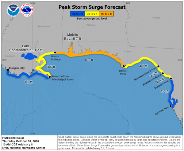
*A 5-7 foot storm surge is still forecast from Ocean Springs, MS to Indian Pass, FL, including Mobile Bay. Highest surge will be east of the storm center across the Florida Panhandle coast. Surge-related flooding depends on the relative timing of the surge and the tidal cycle, and can vary greatly over short distances.
*The cities of Gulf Shores and Orange Beach are encouraging all non‑residents, and residents living in low-lying, flood prone areas to voluntarily evacuate. City officials urge all individuals who are not permanent residents to leave the area immediately and relocate to a safer location. Departing now will help reduce congestion, support emergency operations, and ensure the safety of those who may be most vulnerable during the storm.
*An evacuation order has been issued for the west end portion of Dauphin Island from Pirate’s Cove Street (the two-lane four-lane interchange) west effective at 5pm today.
*Rain amounts on the coast will be in the 5-8 inch range for most places. For inland Alabama, average amounts will be 2-3 inches, with isolated amounts to 4″.
*Isolated tornadoes are possible along and east of the track. The risk Friday night is from Baldwin and Escambia counties east to Dothan in Alabama, and the western Florida Panhandle. On Saturday, a few tornadoes are possible over the eastern third of Alabama. The tornado threat over the western half of the state is very low.
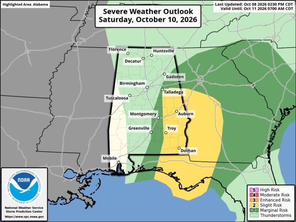
*The most widespread rain will likely move out of Alabama at some point Saturday afternoon; only lingering, isolated showers around Saturday night with diminishing wind (but still breezy).
As always, remember any tropical forecast can change, so watch for updates tonight and tomorrow as Isaias approaches the coast.
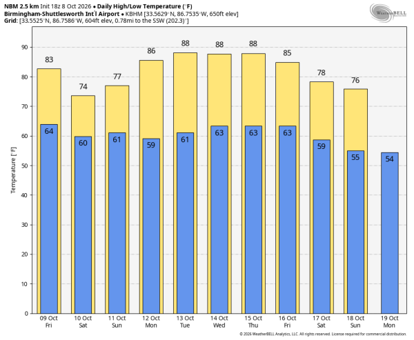
Sunday looks mostly warm and dry, and all of next week looks rain-free with highs well into the 80s. See the video briefing for maps, graphics, and more details.
FOOTBALL WEATHER: The weather looks favorable for Saturday night’s Alabama/Georgia game at Bryant-Denny Stadium in Tuscaloosa (6:30p CT kickoff). Lingering clouds, an outside risk of a passing shower or two. Winds averaging 10-20 mph.
ON THIS DATE IN 1946: A minimal Category 1 hurricane made landfall over Bradenton, Florida, before tracking north-northeast across Tampa Bay. The storm was the last hurricane to make direct landfall in the Tampa Bay area.
Look for the next video briefing here by 6:00 a.m. tomorrow…