


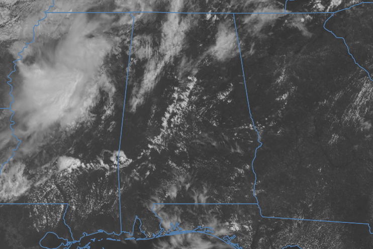
There is a wide range of temperatures across the area as we are seeing lower to mid 80s in the northwest, to already hitting 100 degrees down in portions of the southeast parts of Central Alabama. We do have a few clouds out there bringing some relief from the direct sunlight, and we are starting to see a few showers develop along and south of the I-59/20 corridor over the southwestern quarter of the area.
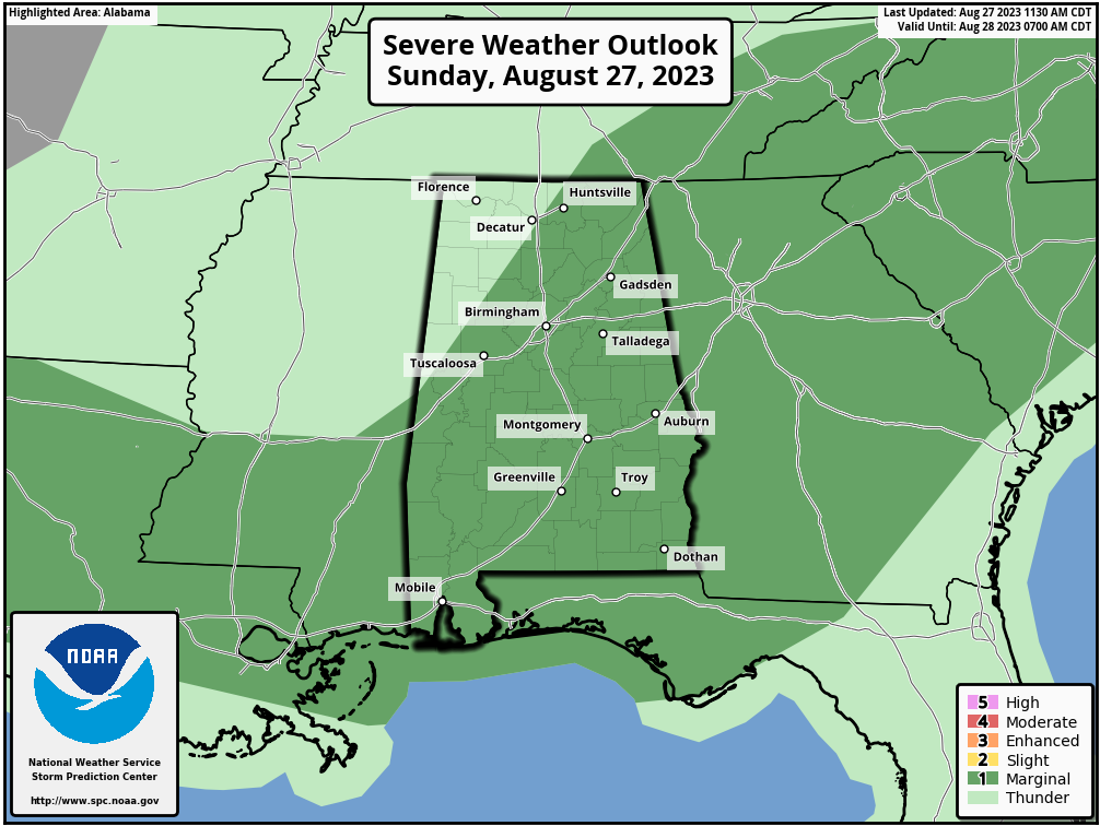
The good news is that the severe storm risk has been trimmed back a little, and now only includes locations along and east of a line from Geiger to Carbon Hill to Hazel Green. However, damaging winds up to 60 mph and hail up to quarter-size will be possible with any storm that is able to become severe. We’ll also have to worry about the heat as all of Central Alabama is under a heat advisory with the potential of heat index values reaching up to 109 degrees. Afternoon highs will be in the lower 90s to the lower 100s.
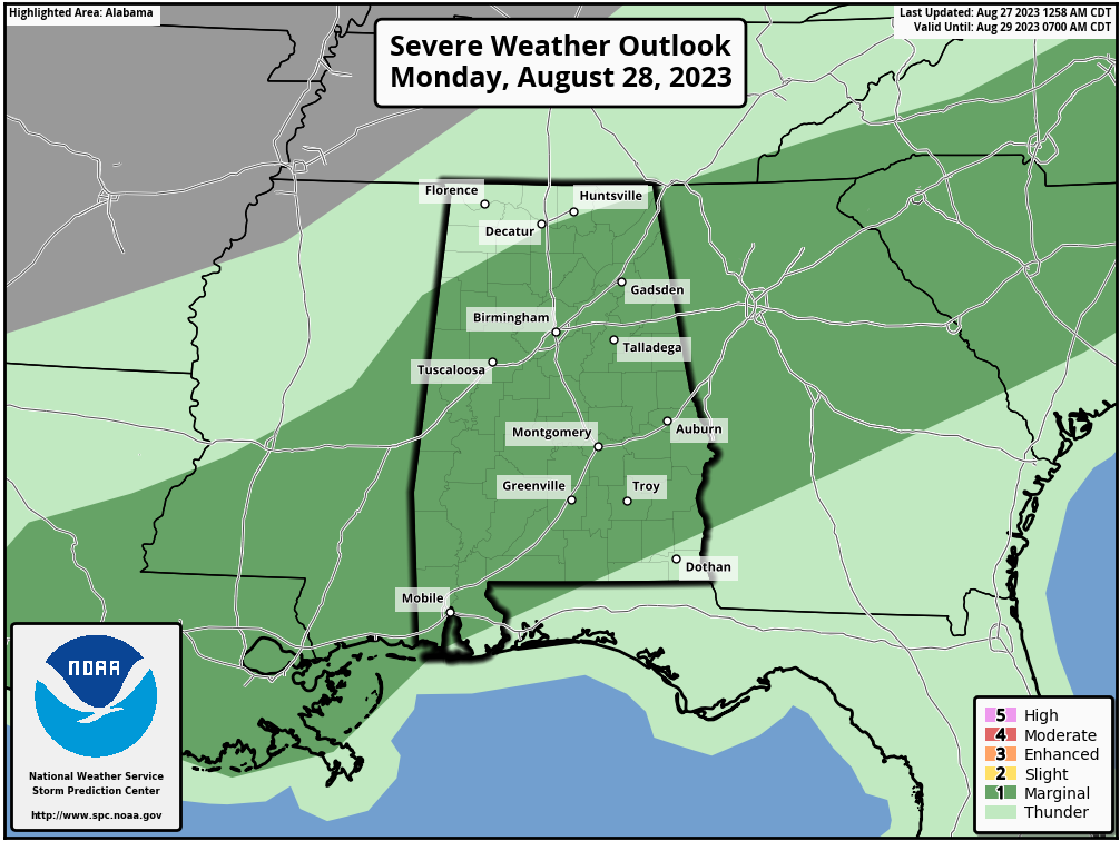
We’ll continue the risk of strong to severe storms on Monday as we’ll have a stalled boundary over the northern portions of the area. Rain & storms will be likely during the afternoon and evening hours for nearly all of Central Alabama, and highs will be in the mid 80s to the mid 90s. A Marginal Risk is up for locations along and south of a line from Haleyville to Redstone Arsenal to Stevenson.
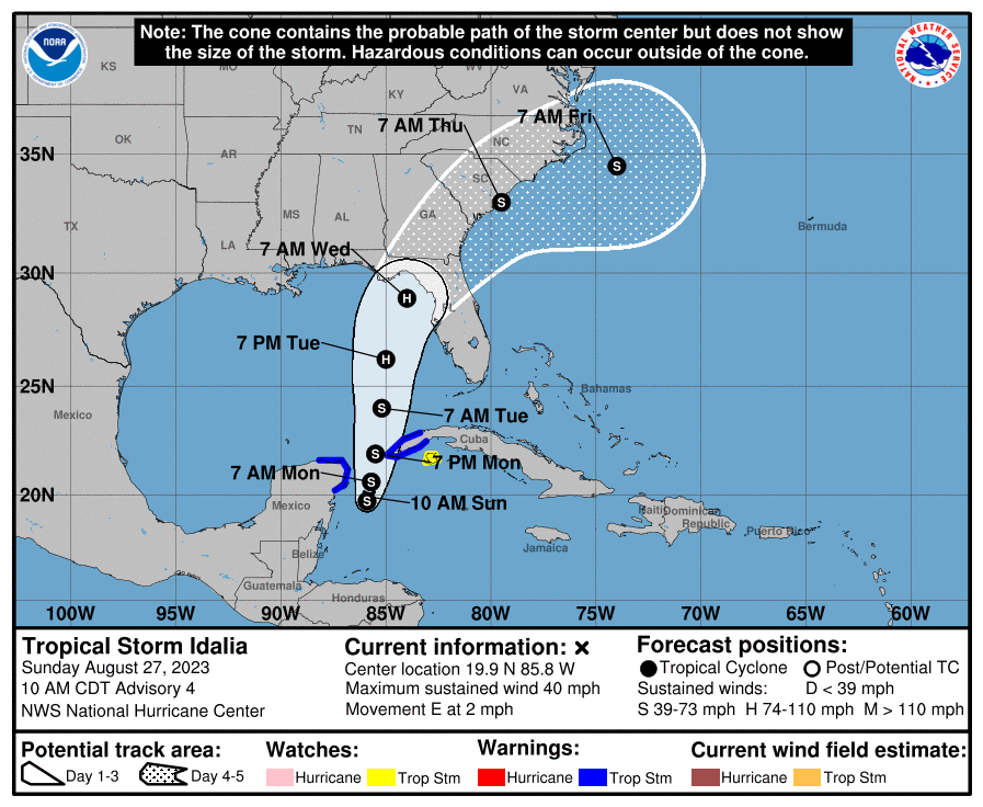
And, now we have Tropical Storm Idalia down in the Caribbean Sea and will be starting its trek across the Gulf of Mexico by tomorrow evening. Winds are up to 40 mph and the pressure is down to 1001 mb. A new update will be out around 1 pm, and there will be a post when that is released. Please check the previous post on the blog for the update announcing that Idalia formed.
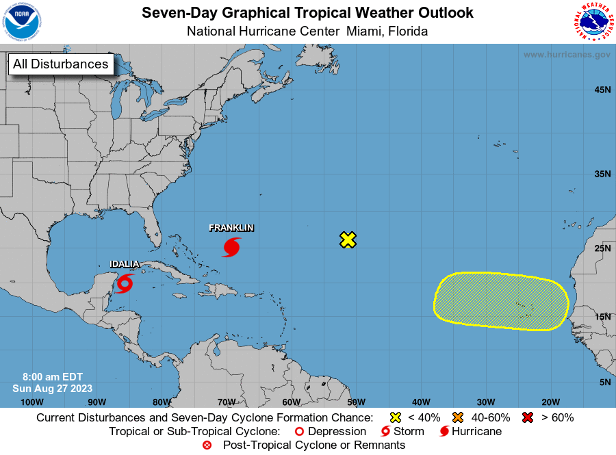
There are other areas of interest out there over the Atlantic, including a strengthening Hurricane Franklin, but none pose a threat to any land mass at this point.



