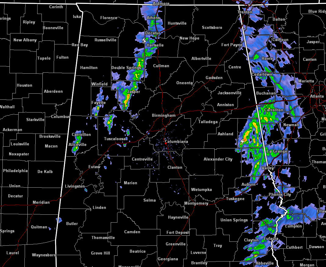
The line is currently stretching from Ardmore back to the south to Decatur to Addison, and ending just south of Berry before becoming broken back to the southwest to the Mississippi state line. It is still pushing very slowly to the east at 25-30 MPH. The Storm Prediction Center still has parts of North Alabama in a slight risk for severe storms through 7:00 AM this morning, but the next update will be out at 1:00 AM and I’m pretty sure they will remove the risk.
The other line that brought the frustration to all of the meteorologists today is finally starting to exit the state into Georgia, but these may actually take until 4:00 AM to completely exit the state.
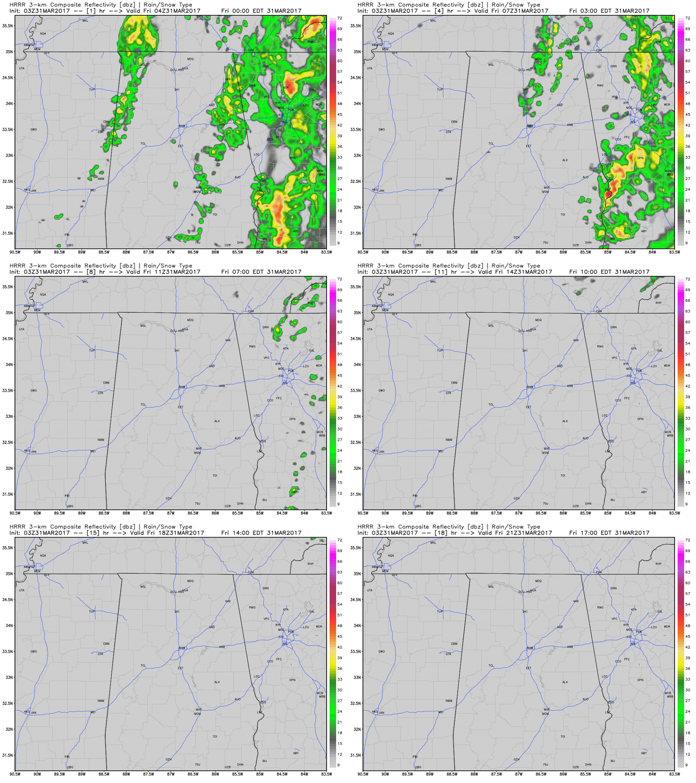
The latest run of the HRRR model shows the line quickly weakening and mostly dissipating by 1:00AM as it nears the I-65 corridor, then finally dissipates totally by 5:00 AM. I do not expect any of these storms to become severe throughout the remainder of the overnight and early morning hours, and I wouldn’t be surprised if areas south of the I-20 corridor didn’t receive any rain from this line after it makes it to the east side of the I-65 corridor. Lows will range from the lower 50s to near 60 degrees across the area.
Friday will be a very nice day across Central Alabama, with mostly sunny skies and nice spring-like temperatures. Afternoon highs will make it up into the lower to mid 70s across much of the area, with upper 70s to near 80 degrees possible in the extreme southern portions of the area.