


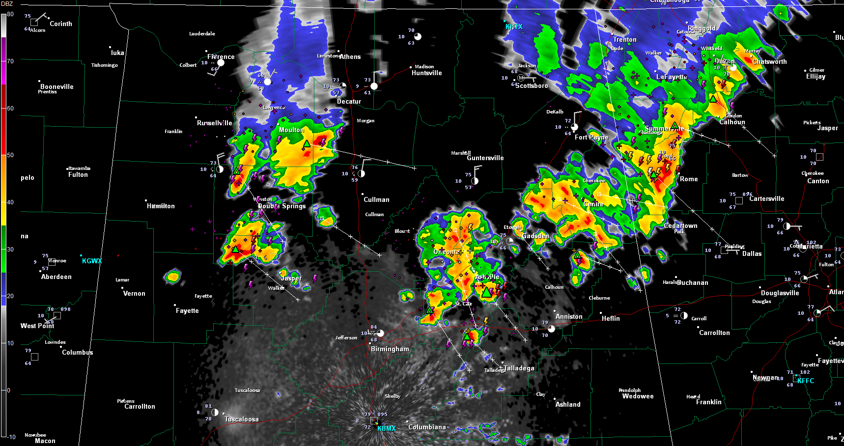
Thunderstorms continue to move southeastward across North and North Central Alabama tonight. They are being caused by an outflow boundary that is pushing southeastward from storms earlier today to our north.
The NWS Huntsville has had warnings over Northwest and Northeast Alabama. They have since expired.
Colbert, Franklin and Lawrence Counties in Northwest Alabama have been under warning. Those storms are now into northern Winston County.
Others are over Northwest Walker County. They will push toward Jasper.
Storms in Blount and northern St. Clair County will brush eastern Jefferson County as well.
Other storms in Etowah and Cherokee Counties will pass east of Gadsden, Hokes Bluff, Glencoe and Jacksonville. They were warned for earlier when they were in Jackson and DeKalb Counties.
Most of the storms will remain below severe limits but there could be an isolated damaging wind gust or large hail report over the next few hours as they push southeast.



