


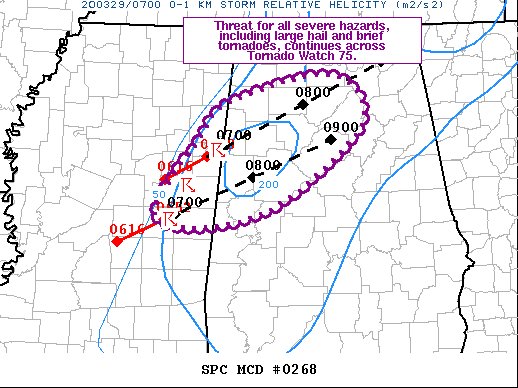
This is the latest Mesoscale Discussion from the Storm Prediction Center:
The severe weather threat for Tornado Watch 75 continues.
SUMMARY…
The threat for all severe hazards, including large hail and brief tornadoes continues across Tornado Watch 75.
DISCUSSION…
Radar signatures of the three embedded supercells in east-central MS have improved over the past half hour or so. Instability within the air mass ahead of these cells has increased slightly over the past hour or so as low-level moisture advection persists just ahead of the cold front. Strong vertical shear remains in place and the overall environment will continue to support organized storms.
Most recent KGWX radar imagery shows more linear character to these storms, suggesting the primary threat will be damaging wind gusts. However, the lead cell in Lamar County AL has an intense radar-based hail core, indicating large hail remains a threat. Additionally, the strong low-level shear (i.e. 0-1 km SRH over 200 m2/s2), supports a brief embedded/QLCS tornado risk.



