


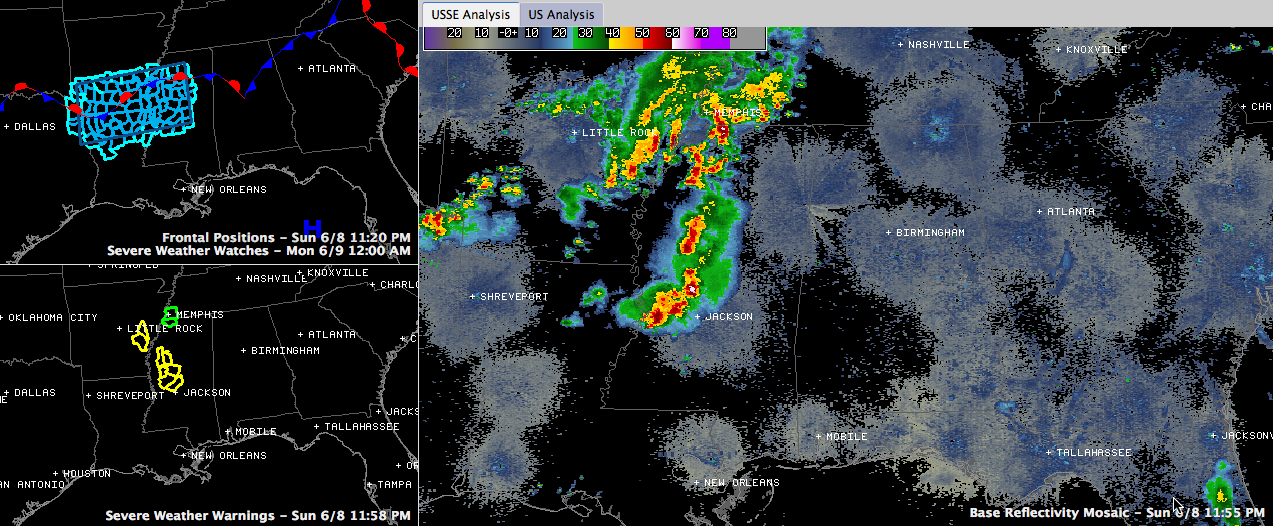
Showers and thunderstorms are moving across Mississippi and western Tennessee tonight. They are about three hours west of the Alabama border now.
There are severe thunderstorm warnings for counties west of Winona and west of Canton.
The storms will run out of the severe thunderstorm watch in about two and a half hours but early indications from the National Weather Service are that it will not be extended into Alabama.
The storms will be into West Alabama by 3 a.m., in the Jasper/Tuscaloosa areas by 4 a.m. and to the I-65 corridor by 5 a.m. pushing into eastern Alabama after that. Indications are that it should be weakening by the time it gets east of I-65. It should remain mainly along and north of I-20.
Be ready for showers and thunderstorms overnight with the outside chance that a few of them will reach severe thunderstorm status.
Ryan Stinnett will be along later to keep you updated as they track into and across the state.



