


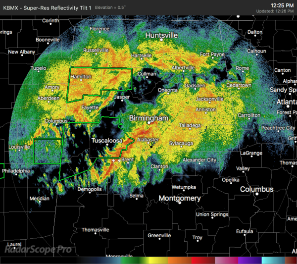
Taken from the latest NWS Birmingham Area Forecast Discussion
Areas of flooding likely as a band of heavy rain set up near & north of Interstate 20; marginal risk of a severe storm.
At 17:10Z/11:10 AM, training rainfall was in progress across a good chunk of the area, with a notable flood threat focused near and north of Interstate 20 where a *high risk* of flash flooding has been outlooked by the WPC. This is the primary concern through tonight.
Observed 12Z soundings from BMX/JAN as well as forecast soundings indicate low amounts of MU-CAPE available within this axis of precipitation. This combined with a southwesterly transport of anomalous precipitable water, 40-knot low-level jet & shortwave impulses aloft will result in areas of embedded heavy rain & a few storms. Such activity will aid in focused areas of high rain rates & enhanced flood risk. Persons should be alert & ready to respond to flooding to protect life and property. Travel should also be done very cautiously, especially after nightfall.
The severe threat today is questionable given the mode of convection and tendency for storms to be elevated; however, some guidance shows that a pool of SB- CAPE will advect northward & reside up against the southern perimeter of the boundary across the southwest part of our area. There’s a good amount of background shear in place which could help organize some stronger cores. I think the overall scenario by a few members may be a bit overdone & prefer to side with the more tempered guidance. So, will maintain the marginal risk but extend the end time to 6 PM this evening.



