


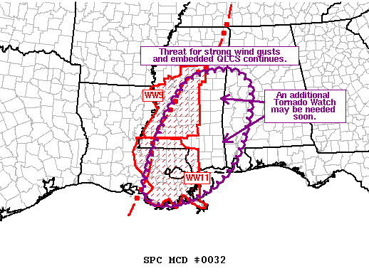
The severe weather threat for Tornado Watch 11, 9 continues.
SUMMARY… The threat for strong wind gusts and embedded QLCS tornadoes continues across central/eastern MS and southeast LA. A downstream watch will be needed soon across eastern MS and western AL.
DISCUSSION… Extensive convective line continues to move eastward across MS and southeast LA. 12Z JAN sounding sampled a strongly sheared and modestly buoyant air mass ahead of the line across MS. Farther south, 12Z LIX sounding was strongly sheared but a warm layer between 850-700 mb resulted in increased convective inhibition. Expectation is for the ascent attendant to the shortwave trough moving across TX to cool this layer, reducing the convective inhibition. Additional moisture advection is anticipated ahead of the convective line. Consequently, an increasingly unstable air mass with moderate buoyancy (i.e. MLCAPE 1000 to 1500 J/kg) is expected to develop across much of southeast LA, eastern MS and western AL during the next few hours. This should allow the persistence of the ongoing line through eastern MS into western AL with an attendant threat for strong wind gusts and embedded tornadoes. A downstream watch will likely be needed over portions of the area to address this threat.
Recent radar trends within the convective line suggest the southern end over southeast LA may become more dominant over the next hour or two. 9km CAPPI shows stronger, more persistent updrafts over southeast LA while those over MS have started to weaken. This portion of the line is also oriented a bit more orthogonal to the deep shear vector, suggesting some increase in forward speed is possible.



