Here is the latest Hazardous Weather Outlook from the NWS Birmingham Office…
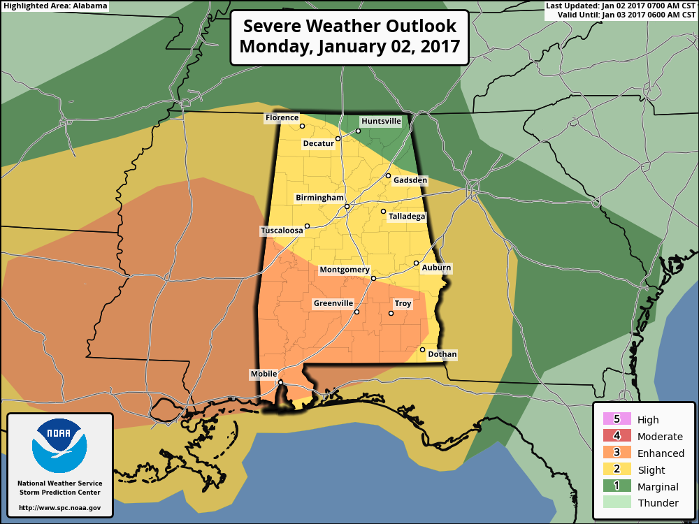
A limited risk for severe storms is possible through tonight for all of our counties for large hail and damaging winds up to 60 miles per hour.
A risk for possible tornadoes, damaging winds up to 60 miles per hour and large hail will exist this afternoon and overnight from around noon to around 3 am across portions of Central Alabama.
The risk will be generally along and south of a line from Millport to Calera to Lafayette from noon to 8PM, shifting to along and south of a line from Livingston to Calera to Cheaha from 8PM to around 3AM.
An enhanced risk will be possible along and south of a line from Demopolis to Montgomery to just north of auburn initially from around noon to 8PM, shifting to along and south of a line from Selma to just north of Auburn from around 8PM to 3AM. Although uncertainty remains, confidence has increased some. The main threats will be possible tornadoes, damaging winds up to 60 mph, and large hail.