


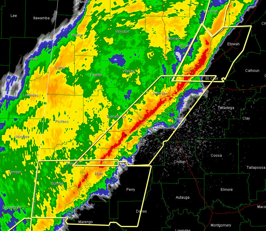
A line of intense thunderstorms continues moving eastward across Alabama tonight.
It extends generally along I-59 from east of Tuscaloosa all the way to west of Fort Payne.
It continues southwestward through Hale and Greene Counties.
Winds are averaging 55 mph in downtown Birmingham as the squall line is at its worst there. There is extremely heavy rain and thunder.
All tornado warnings have expired or have been canceled.
Severe thunderstorm warnings continue for all areas ahead of the line.
Some folks in the path in the next 30 minutes include…
Crossville
Collinsville
Boaz
Altoona
Attalla
Gadsden
Rainbow City
Ashville
Ragland
Odenville
Trussville
Leeds
Moody
Irondale
Homewood
Hoover
Pelham
Alabaster
West Blocton
Montevallo
Centreville
Marion
Greensboro



