


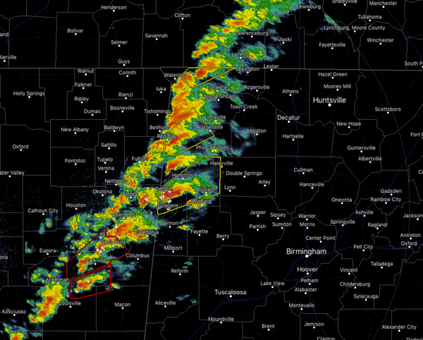
We have a line of storms stretching from Florence down to the south-southwest through Hackleburg and Hamilton and into Guin and Detroit. Much of the line is a grouping of supercells, some of which are showing some signs of rotating. At this point, no tornado warnings are in effect for North/Central Alabama, but we do have a few Severe Thunderstorm Warnings currently in effect.
Instability continues to rise over the western parts of the state already exceeding 1,000 J/kg close to the state line. The line of storms continue to move into an atmosphere with higher helicity values, over 400 m2/s2 in some parts of northwest Alabama.
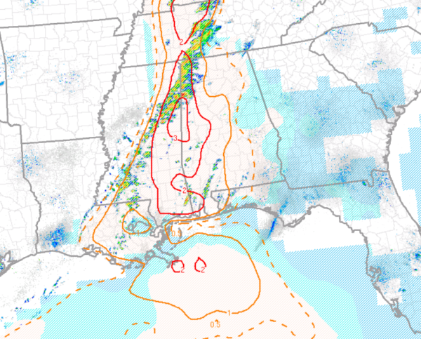
STP values continue to climb over the western half of the area, now with 3.0 showing up over the locations closest and over the state line.
We’ll continue to have these cells strengthen over the next couple of hours and we may see some tornado warnings issued if these cells show more signs of tighter rotations.
Stay weather aware and keep checking back often.



