


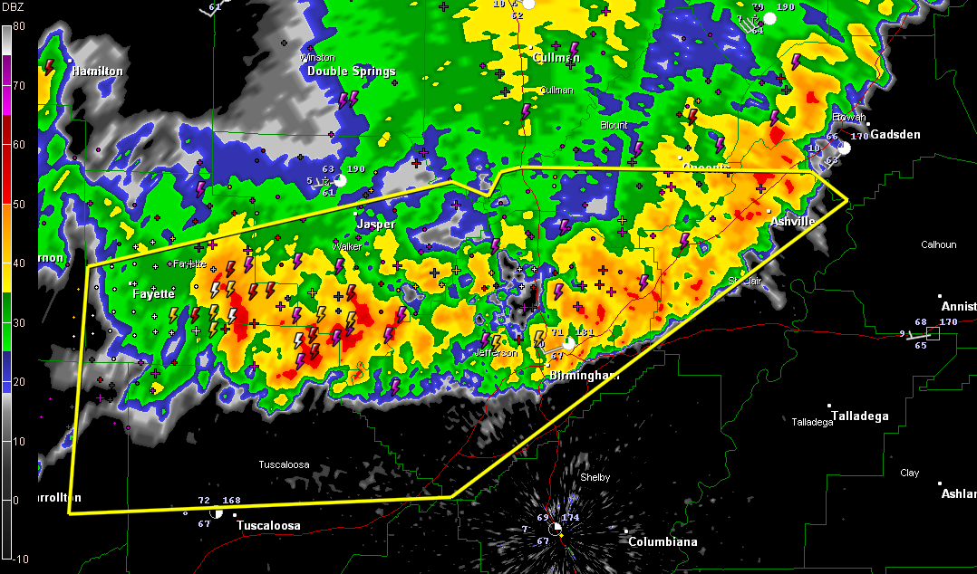
Getting reports from Marion County that there is significant wind damage in Marion County from this line of severe thunderstorms. One roof was blown from a house and a tractor shed was destroyed. Trees and power lines are down.
Estimate winds to 50 mph right now in Trussville as the worst of it is on top of Trussville now. The NWS Huntsville has issued a high wind warning for their counties from Cullman and Morgan through Marshall and into Jackson and DeKalb. Possible gravity wave or wake low at work here. I wouldn’t be surprised if that is what roared through Trussville for several minutes.
The line extends now from Ashville to Moody to Mountain Brook then back through western Jefferson County and into northern Tuscaloosa County.
The line is sagging southward. The eastern part has weakened a bit in the past 15 minutes. But the stroms over western Jefferson County remain quite strong and a new severe thunderstorm warning may be required for parts of Jefferson and Shelby Counties.
The line may stall in the vicinity of I-20. This could be the first of several waves of storms to work across the area today. More storms are developing right now near Columbus MS and will affect Pickens County shortly. They will move toward Tuscaloosa County.
Be alert for strong damaging winds, deadly lightning, very heavy rain and hail as the line approaches you. Be in safe shelter before it arrives.



