


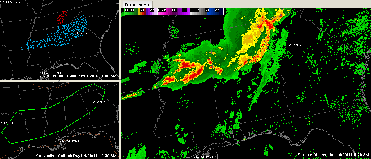
Across Central Alabama this morning, we have a slowly weakening thunderstorm complex that is pushing into East Alabama. It has produced fairly widespread wind damage, with numerous reports of trees down, especially across Lamar and Marion Counties and over parts of Northeast Alabama.
A severe thunderstorm warning expired for Jefferson, St. Clair, southern St. Clair and Talladega Counties at 715 a.m.. The activity that prompted this is slowly weakening and significant weather advisories will probably be sufficient ahead of it as it moves into eastern Alabama. Probably won’t see any more severe thunderstorm warnings from it. abut more is on the way from Mississippi. Already watching severe storms near Starkville, that will move into West Alabama soon.
A severe thunderstorm watch continues for much of Central Alabama until 9 a.m. A new watch has been issued over into Georgia and the Carolinas. The watch shown on this graphic for Tennessee has been canceled.
More thunderstorms are over Central Mississippi at this hour. This will intensify and move into Central Alabama later this morning. We expect more severe weather later today as a warm and unstable airmass continues south of the raincooled air from this morning’s storms. The SPC has the area from east of Dallas to Atlanta including much of Alabama in their standard level severe weather risk for today. The main threats will be high wind an



