


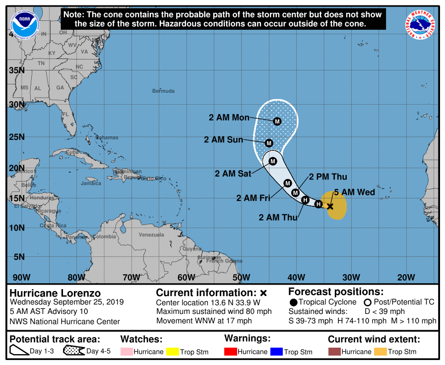
SUMMARY OF 400 AM CDT INFORMATION
LOCATION…13.6N 33.9W
ABOUT 640 MI…1030 KM W OF THE SOUTHERNMOST CABO VERDE ISLANDS
MAXIMUM SUSTAINED WINDS…80 MPH…130 KM/H
PRESENT MOVEMENT…WNW OR 285 DEGREES AT 17 MPH…28 KM/H
MINIMUM CENTRAL PRESSURE…988 MB…29.18 INCHES
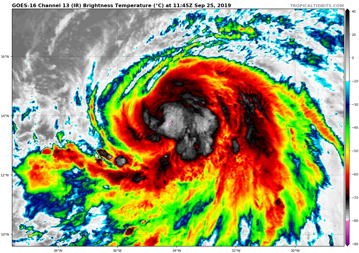
Deep convection has continued to increase in coverage and intensity near the center of Lorenzo during the past several hours. There has been no good microwave passes over the cyclone since yesterday, however, a partial SSMIS pass showed hints that a mid-level eye is forming. The initial intensity has been increased to 70 kt based on a blend of the latest subjective Dvorak estimates from TAFB and SAB, and objective estimates from the UW-CIMSS ADT and SATCON. Lorenzo is the 5th hurricane of the Atlantic hurricane season.
The SHIPS and DTOPS rapid intensification probability models both show that there is a greater than 50 percent chance that Lorenzo will strengthen by 25 kt or more during the next 24 hours. The large size of the cyclone appears to be the only obvious inhibiting factor to rapid intensification since the environment is otherwise quite favorable for continued strengthening. The NHC forecast now shows Lorenzo becoming a major hurricane in 36 hours, faster than previously anticipated. By 72 h and beyond, most of the guidance keeps Lorenzo in a nearly steady-state. In reality, most strong hurricanes have some short-term fluctuations in intensity, but such fluctuations are nearly impossible to forecast this far out in time. Regardless of its exact intensity, confidence is high that Lorenzo will be a large and powerful hurricane over the eastern and central Atlantic through the rest of this week.
No changes of significance were made to the track forecast. Lorenzo is still forecast to move west-northwestward for the next day or so, before turning northwestward toward a weakness in the subtropical ridge. A turn toward the north is anticipated by the end of the forecast period. The models are still in fairly good agreement on the track of the hurricane, and the NHC forecast is between the consensus aids HCCA and TVCA.



