


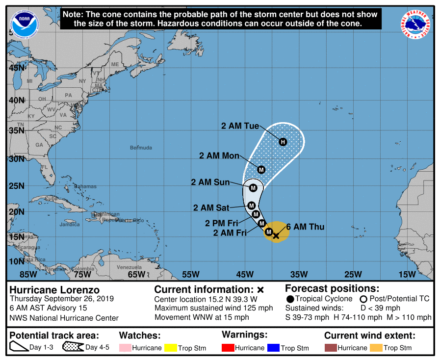
SUMMARY OF 500 AM CDT INFORMATION
LOCATION…15.2N 39.3W
ABOUT 995 MI…1600 KM W OF THE SOUTHERNMOST CABO VERDE ISLANDS
MAXIMUM SUSTAINED WINDS…125 MPH…205 KM/H
PRESENT MOVEMENT…WNW OR 290 DEGREES AT 15 MPH…24 KM/H
MINIMUM CENTRAL PRESSURE…955 MB…28.20 INCHES
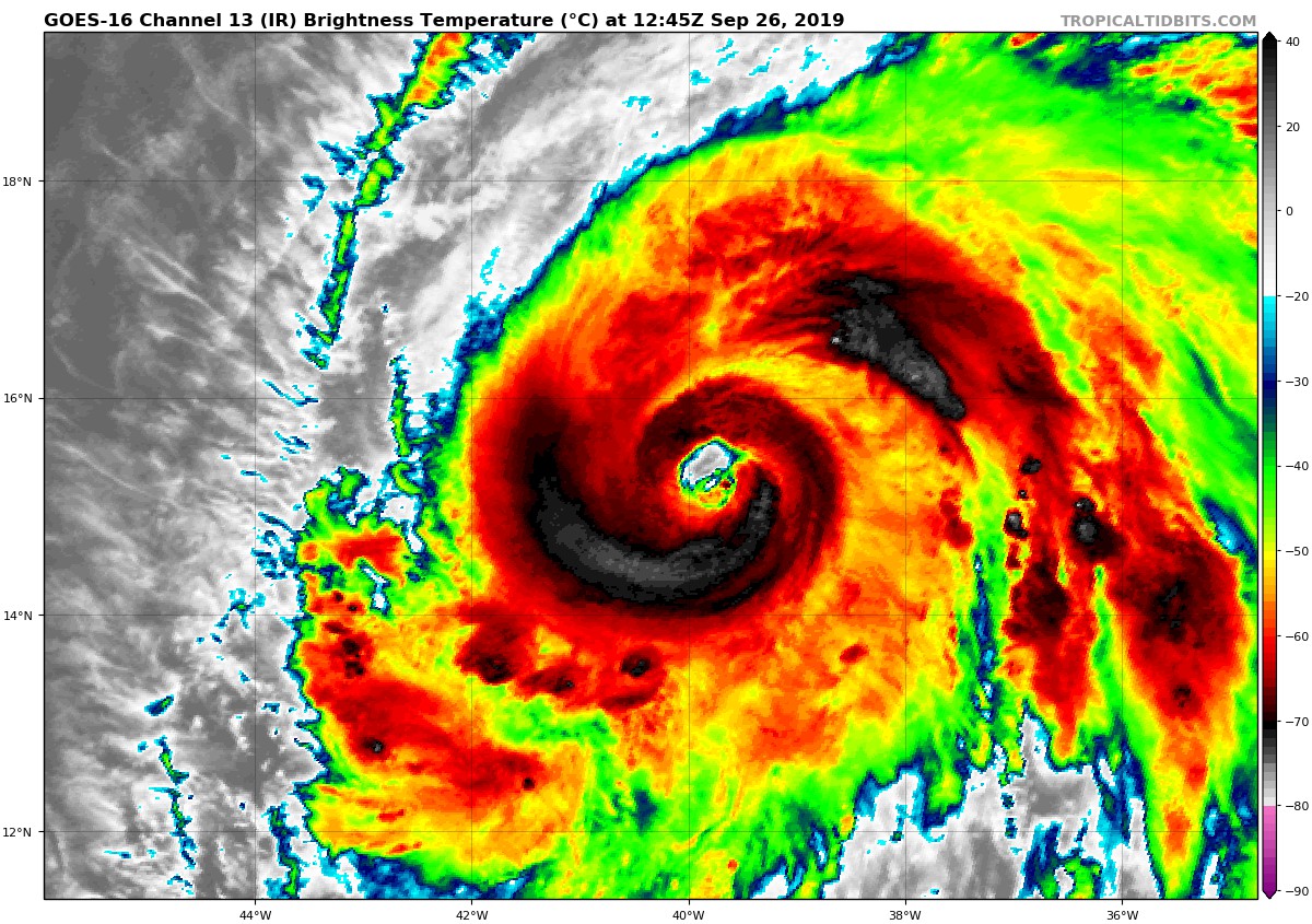
Shortly after the issuance of the 0900 UTC advisory, Lorenzo’s eye quickly and drastically became more apparent in conventional satellite imagery. The slightly ragged but clearing eye of the hurricane is surrounded by very cold cloud tops, and it has become clear that Lorenzo is rapidly intensifying. A 0900 UTC TAFB Dvorak classification of 6.0/6.0 (115 kt) was used as the primary basis for increasing the intensity of Lorenzo. Because objective fixes from just a few hours ago were much lower, the intensity of the hurricane has been increased, perhaps conservatively, to 110 kt. Since this is 10 kt above the previous 12-h forecast, a special advisory is required to update the intensity forecast.
Additional strengthening is possible later today. Earlier intensity guidance indicated that Lorenzo’s intensity should level off in a day or so, though none of the guidance correctly anticipated the rate at which the hurricane has strengthened this morning. Now that the hurricane has a closed eyewall, fluctuations in intensity due to eyewall replacement cycles are also possible, though this is not explicitly reflected in the updated forecast. By the end of the forecast period, the updated NHC forecast is relaxed to the original forecast and shows some gradual weakening. Further adjustments, especially at 72 h and beyond, may be required later this morning.
No changes were made to the track forecast, which is based on the previous regular advisory.



