


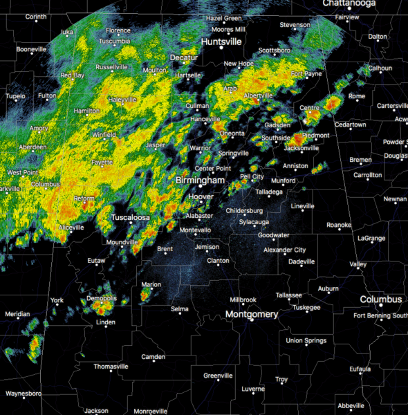
As of 5:35 pm this evening, we continue to have widespread showers and an occasional clap of thunder or two moving over the north and western parts of the area. These are continuing to push slowly to the east and southeast slowly. The good news is that there is just not enough low-level and upper-level support to go along with the instability and shear that is available for the threat of severe storms to continue.
This activity will continue to move to the east and southeast slowly through the remainder of the evening and into the overnight hours, with the volume of the activity beginning to decrease during the late-night hours. A few claps of thunder will be possible and we can’t rule out a brief strong storm with gusty winds or some small hail, but there is no threat of severe weather.

DID YOU KNOW…
Montgomery tied the record high of 88 degrees set back on this date in 2011. Folks, that’s almost 90 degrees in March. It’s just the first full day of Spring and we’re already hitting summer-like highs. #SlowDownMotherNature



