


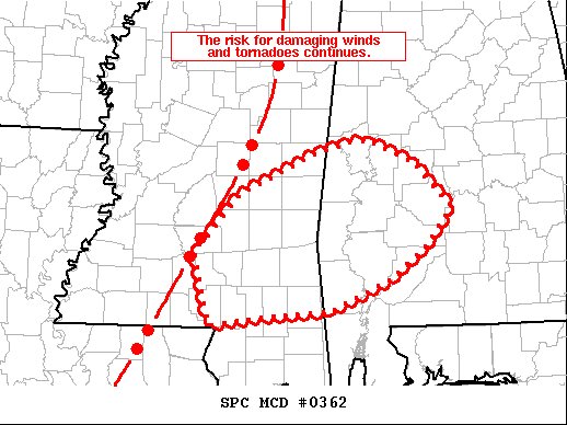
SUMMARY… A mature QLCS with a history of damaging winds and tornadoes will continue east this evening. Very strong shear and sufficient buoyancy will continue to support the risk for severe wind gusts (some 70+ mph) and tornadoes.
DISCUSSION… As of 2315 UTC, regional radar imagery showed an expansive QLCS moving quickly eastward across the middle Gulf Coast and MS River Valley. To the east of the squall line, regional VWPS were sampling an increasingly strong southerly low-level jet with 1 km flow near 60 KTS. Expansive cloud cover and meager surface moisture have so far limited buoyancy across much of southeastern MS, southwestern AL. However, as the low-level jet strengthens across this area ahead of approaching upper level ascent, rapid airmass modification is expected to result in sufficient destabilization for a continued severe risk. Middle and upper 60s F surface dewpoints just offshore should be quickly advected inland, supporting approx 1000 J/kg of MLCAPE ahead of the squall line. The strong low-level jet will also continue to enlarge hodographs with 400-500 m2/s2 of ESRH expected. The potent low-level shear and sufficient buoyancy will support a risk for line-embedded supercells capable of damaging wind gusts and a few tornadoes this evening.



