


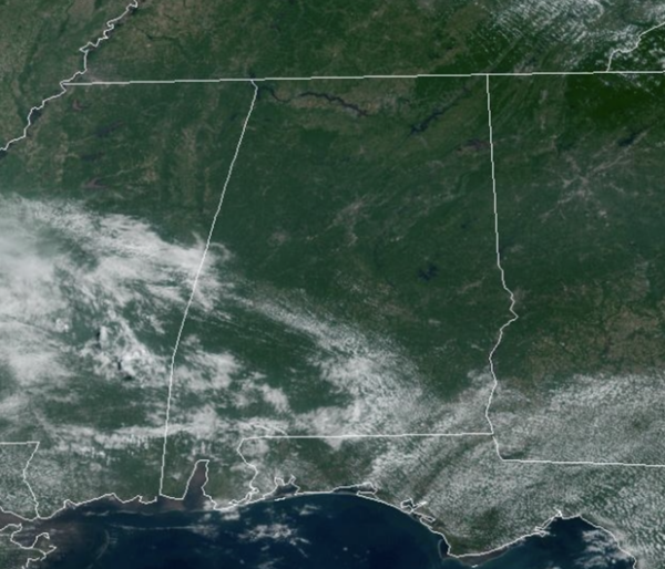
The upper-ridge “heat dome” continues to expand eastward, bringing Alabama the hottest weather so far this year. Today and tomorrow, highs will be in the mid 90s, followed by upper 90s Thursday and Friday. Some spots could touch the 100 degree mark, and with high humidity levels heat index values will be well over 105° and could surpass 110°.
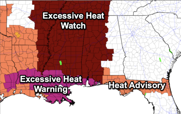
There is an “excessive heat watch” in effect for the areas along and west of I-65. The heat index for eastern counties could reach 105° on these days. The “excessive heat watch” will become an an “excessive heat warning.”
A few isolated pop-up afternoon storms remain possible daily, but most of Alabama will remain dry. However, where any storms develop, they will produce heavy downpours, and tremendous amounts of lightning and thunder..BIG HEAT, BIG STORMS.
FOURTH OF JULY WEEKEND: The upper ridge will weaken a tad over the weekend and into next week, meaning heat levels come down a tad as well. We expect highs in the mid 90s Saturday and Sunday, followed by low 90s Monday and Tuesday. With higher moisture content, there will be a better chance for some afternoon showers and storms, but still, most locations will remain dry. Chance of any one location seeing a storm each day will be in 30-40% range.
REST OF NEXT WEEK: Higher rain chances and lower heat levels as highs will be closer to 90° Wednesday through Friday. Scattered showers and thunderstorms becoming more numerous as the ridge continues to weaken.
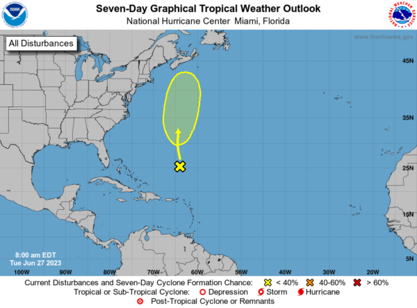
IN THE TROPICS: An area of low pressure, associated with the remnants of Cindy, is producing disorganized showers and thunderstorms more than 400 miles to the south of Bermuda. While strong upper-level winds are expected to prevent redevelopment of this system over the day or so, environmental conditions could become marginally conducive for some gradual development during the latter part of this week. The system is forecast to move generally northward over the western Atlantic, passing near Bermuda on Thursday. Formation chance through 7 days…low…30 percent.
BEACH FORECAST CENTER: Get the latest weather and rip current forecasts for the beaches from Fort Morgan to Panama City on our Beach Forecast Center page. There, you can select the forecast of the region that you are interested in visiting.
WORLD TEMPERATURE EXTREMES: Over the last 24 hours, the highest observation outside the U.S. was 120.4F at Ahwaz, Iran. The lowest observation was -96.5F Concordia, Antarctica.
CONTIGUOUS TEMPERATURE EXTREMES: Over the last 24 hours, the highest observation was 118F at Rio Grande Village, TX. The lowest observation was 28F at Bryce Canyon, UT.



